Real places you can visit and real objects you can see in museums, connected to the books of Joshua, Judges and Ruth: Israel's entry into Canaan, the long years of the judges, and the family story that leads to King David. Each one is marked honestly, so you can tell solid evidence from tradition and from claims that are still argued over.
ConfirmedThe place or object is real and is clearly the one the Bible names. For a written object, such as an inscription or a scroll, it means the object is genuine and its words are read with confidence, not that every event it mentions is proven.7
Traditional siteA real place that long tradition links to the Bible, but the exact spot cannot be proven.1
DisputedInformed people disagree, or the claim rests on weak evidence.3
BackgroundShows the world the Bible describes, but does not name a Bible person or event.4
Joshua: Into the Promised Land
1
Jericho: the mound of Tell es-Sultan
Joshua 6:20 · Joshua 6:24 · Hebrews 11:30
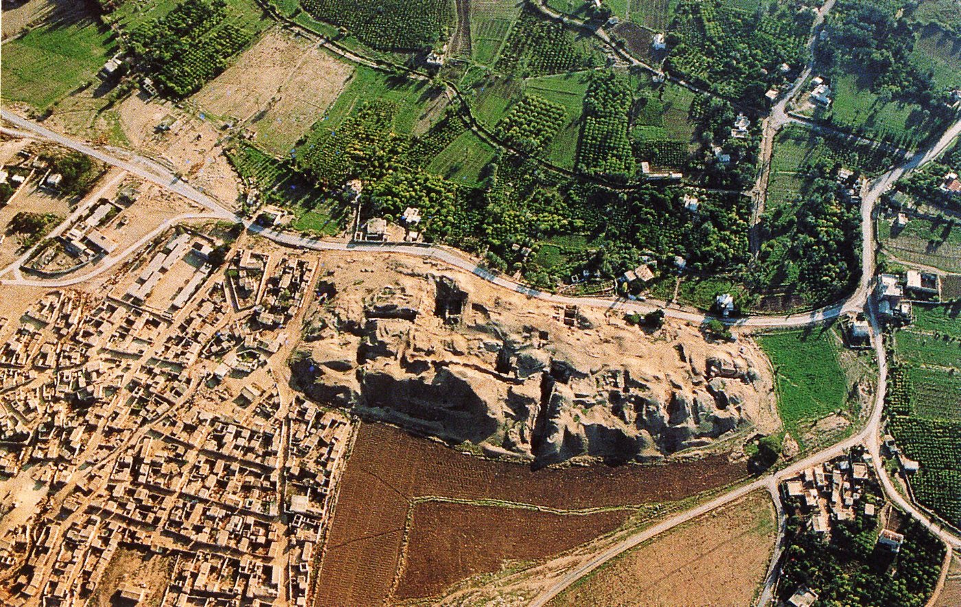
DisputedAir view of the mound of Tell es-Sultan, ancient Jericho. Fullo88 at Italian Wikipedia, via Wikimedia Commons, Public domain.
So the people shouted when the priests blew with the trumpets: and it came to pass, when the people heard the sound of the trumpet, and the people shouted with a great shout, that the wall fell down flat, so that the people went up into the city, every man straight before him, and they took the city.
Joshua 6:20, KJV
Joshua 6 tells how the walls of Jericho fell after Israel marched around the city for 7 days, and how Israel then burned the city. Ancient Jericho is Tell es-Sultan, a 'tell' (a hill built up from the ruins of towns built one on top of another) beside a strong spring at the modern city of Jericho; people lived there from about 10,000 BC. One city there from the Middle Bronze Age (about 2000 to 1550 BC) is called City 4 by archaeologists. It had a stone wall holding up the bank of earth around it, with mudbrick walls above. It ended in a great fire. Diggers found fallen mudbricks piled at the foot of the wall and many jars of grain burned in the houses. Everyone agrees this burned city existed. The argument is over when it was destroyed and whether that fits Joshua's account.
Where it is today
Tell es-Sultan is about 2 kilometres north of the centre of the modern city of Jericho, in the West Bank. In 2023 UNESCO added Tell es-Sultan to its World Heritage List. Access can change, so check before planning a visit.
Date
City 4 was destroyed at the end of the Middle Bronze Age. Carbon dates put this in the late 1600s or the 1500s BC; Bryant Wood dates it to about 1400 BC. The early date for Joshua is about 1406 BC; the late date is in the 1200s BC.
Why this label: The place is confirmed: scholars broadly agree that Tell es-Sultan is Jericho. What is disputed is the date of the city's destruction, and whether any destruction found there matches Joshua 6.
Good to know
The digs: John Garstang (1930s) dated the fallen walls to about 1400 BC. Kathleen Kenyon (1950s) dated the destruction to about 1550 BC, near the end of the Middle Bronze Age. She linked it to Egyptian wars of that time against the Hyksos, foreign kings who had ruled northern Egypt and were driven out. She found no walled city at about 1400 BC, only signs of a small settlement for a short time. In 1990 Bryant Wood argued for about 1400 BC from the pottery, the order of the layers, Egyptian scarabs (small beetle-shaped seals), and a carbon-14 date of 1410 BC (give or take 40 years) published by the British Museum laboratory. That date was later found to be wrong and was corrected to about 1590 or 1527 BC, give or take 110 years. In 1995 Hendrik Bruins and Johannes van der Plicht carbon-dated burned grain from the destruction to the late 1600s or the 1500s BC (carbon-14 dating measures the carbon left in things that were once alive, such as grain or wood).
Early-date view (about 1406 BC): Wood still holds that the pottery and Egyptian history point to about 1400 BC, and says carbon dates for this period often come out 100 to 150 years earlier than dates from written history. He also says the finds match the story: the walls fell, the city was burned, and many jars of grain were left behind. In his view this fits a short siege just after the harvest (Joshua 3:15) and a city whose goods Israel was told not to take (Joshua 6:17-18).
Late-date view (1200s BC): little is left from that century, but supporters say rain wore away the top of the mound.
Newer digs: the Italian-Palestinian team led by Lorenzo Nigro reports that people lived on the mound again in the 1300s and 1200s BC. They added a mudbrick wall on top of the old city wall and had a building for local rulers that was later destroyed. Nigro says levelling for building in the Iron Age cut away most of the upper layers, which is why little from the 1200s BC is left.
Doubting view: most scholars think the conquest stories were written down centuries later and are not a record of one real campaign. Nigro himself warns against expecting the ground to match the Bible's story point by point.
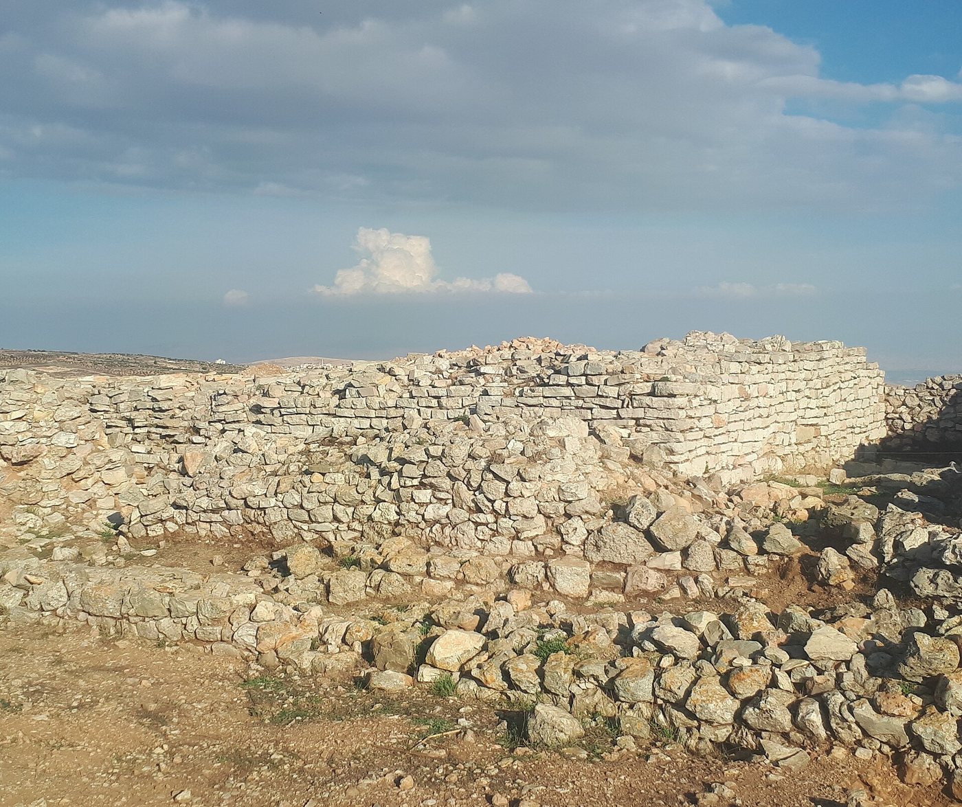
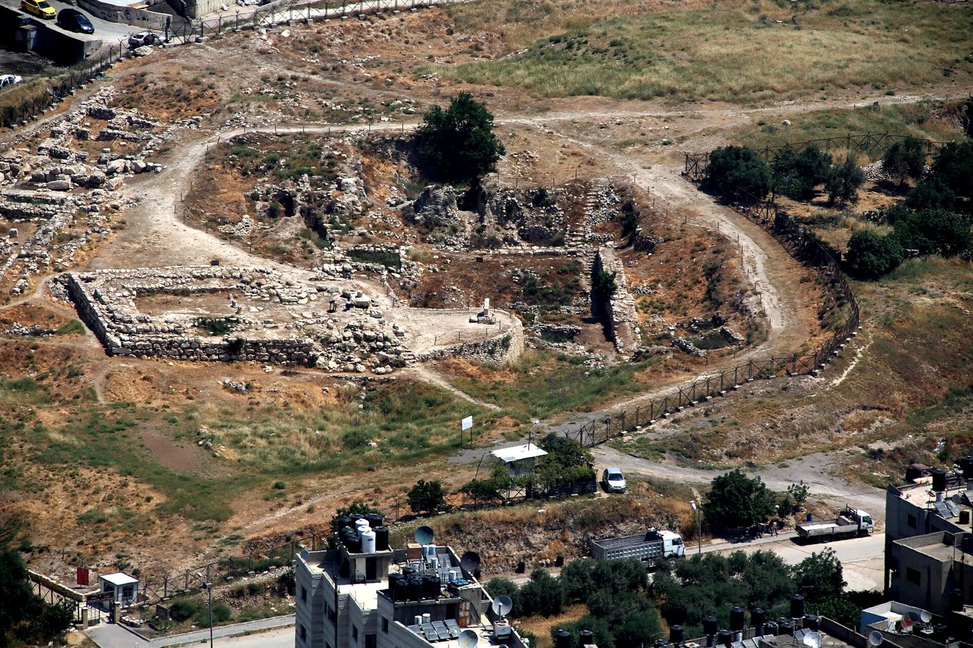
DisputedRuins at et-Tell, the site most scholars identify as Ai. Alex Ostrovski, via Wikimedia Commons, CC BY-SA 4.0.
And Joshua burnt Ai, and made it an heap for ever, even a desolation unto this day.
Joshua 8:28, KJV
Joshua 7 and 8 tell how Israel was beaten at Ai, then took the city by an ambush and burned it. The Bible places Ai beside Beth-aven, east of Beth-el (Joshua 7:2). Most scholars identify Ai with et-Tell, a large ruin about 15 kilometres north of Jerusalem; its Arabic name means 'the ruin heap', much like the Hebrew name Ai, 'the ruin'. A smaller site 1 kilometre to the west, Khirbet el-Maqatir ('khirbet' means ruin), is put forward instead by Bryant Wood and Scott Stripling of the Associates for Biblical Research, who dug there from 1995 to 2001 and again from 2009 to 2016.
Where it is today
Both sites are near the village of Deir Dibwan, about 15 kilometres north of Jerusalem, in the West Bank. Access can be limited, so check before planning a visit.
Date
et-Tell: a walled city from about 3100 to 2400 BC, then empty until a small farming village from about 1200 to 1050 BC. Khirbet el-Maqatir: a small fort from about 1650 BC that was burned in the late 1400s BC, according to its excavators.
Why this label: Which ruin is Ai is itself disputed, and no inscription naming Ai has been found at either site. Et-Tell had no city in Joshua's time on either the early or the late date (only a small, unwalled village began there about 1200 BC), and the case for Khirbet el-Maqatir has not won wide acceptance.
Good to know: Judith Marquet-Krause (1930s) and Joseph Callaway (1964 to 1970) dug et-Tell and found no town there between about 2400 BC and about 1200 BC, so no city stood there for Joshua to take on either date.
Early-date view (about 1406 BC): Wood and Stripling say Khirbet el-Maqatir fits Joshua better. They point to its small size (Joshua 7:3 says the people of Ai 'are but few'), its gate on the north side and the valleys nearby (Joshua 8:11 puts Israel's camp north of Ai, across a valley). It had a small fort, about 1 hectare, with very thick walls and a gate on the north side, that was burned in the late 1400s BC. Wood thinks et-Tell is the Ai of Abraham's day (Genesis 12:8) and that the name later passed to the nearby fort.
Late-date view (1200s BC): no Ai from that century has been found either. Ralph Hawkins suggests a smaller fight with people living among the old ruins at et-Tell; earlier, William Albright suggested that the story of the capture of nearby Beth-el was later told of Ai.
Doubting view: many scholars, following Martin Noth, think the story grew up to explain a huge ancient ruin whose very name meant 'the ruin'.
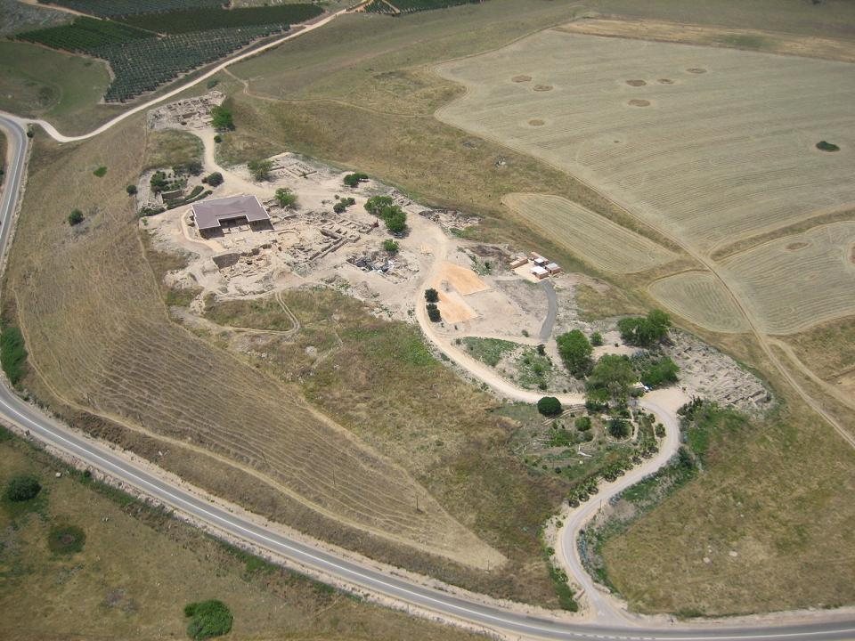
ConfirmedAir view of the upper city of Tel Hazor. Unknown photographer, via Wikimedia Commons, Public domain.
And Joshua at that time turned back, and took Hazor, and smote the king thereof with the sword: for Hazor beforetime was the head of all those kingdoms.
Joshua 11:10, KJV
Joshua 11 says Hazor was 'the head of all those kingdoms' and that Joshua burned it: of the cities 'that stood still in their strength', Hazor was the only one Israel burned (Joshua 11:13). Judges 4 later speaks of Jabin, king of Canaan, who reigned in Hazor. Tel Hazor, north of the Sea of Galilee, is the largest ancient site in northern Israel: an upper city of about 12 hectares and a lower city of more than 70 hectares. Hazor is named in Egyptian records and in letters from Mari in Syria (1700s BC), and in the Amarna letters of the 1300s BC (see the Amarna letters entry) its ruler is one of the few rulers in Canaan who calls himself 'king'. Two of those letters (EA 227 and 228) come from kings of Hazor, and in another (EA 148) the king of Tyre complains that the king of Hazor had joined the Habiru, bands of raiders and outlaws.
Where it is today
Tel Hazor National Park, about 14 kilometres north of the Sea of Galilee, Israel. Finds are shown in a museum at Kibbutz Ayelet HaShahar and in the Israel Museum, Jerusalem. Since 2005 Hazor has been part of the UNESCO World Heritage Site 'Biblical Tels: Megiddo, Hazor, Beer Sheba'.
Date
A great city from about 1750 BC. Its last Canaanite city was burned in the 1200s BC (the exact date is still unclear). Early-date scholars point to an earlier destroyed level from about 1400 BC. Hazor was later rebuilt as a smaller Israelite city and was destroyed by Assyria in 732 BC.
Why this label: This label is for the place only: scholars broadly agree that Tel Hazor is the Hazor of the Bible, from its location, its great size and the ancient records about it. Who burned the city, and when, is disputed.
Good to know: Yigael Yadin (1950s) and Amnon Ben-Tor (from 1990) found that the last Canaanite city ended in a great fire in the 1200s BC, with burned cedar beams, jars of burned wheat, and statues whose heads and hands had been deliberately cut off.
Late-date view (1200s BC): Ben-Tor argues that the Israelites did it. He sees the damaged statues as an Israelite practice and rules out the Egyptians, the Sea Peoples (sea raiders who included the Philistines) and rival Canaanite cities.
Early-date view (about 1406 BC): Douglas Petrovich and Bryant Wood argue that Joshua burned an earlier Hazor about 1400 BC (Ben-Tor's dig report instead suggests that this earlier destruction may have come from a campaign of Pharaoh Thutmose the Third), and Wood links the fire of the 1200s BC to the war of Deborah and Barak against a later king Jabin (Judges 4:24). James Hoffmeier, who holds the late date, objects that Judges 4 never says Hazor itself was attacked.
Other views: Sharon Zuckerman, a co-director of the dig, held that newer dating puts the fire too early for the Israelites and thought a revolt inside the city caused it. Scholars who doubt a single conquest, such as Israel Finkelstein, think Israel grew up mainly from within Canaan itself.
The Amarna letters: Canaan's kings write to Pharaoh
Joshua 10:1 · Joshua 11:1
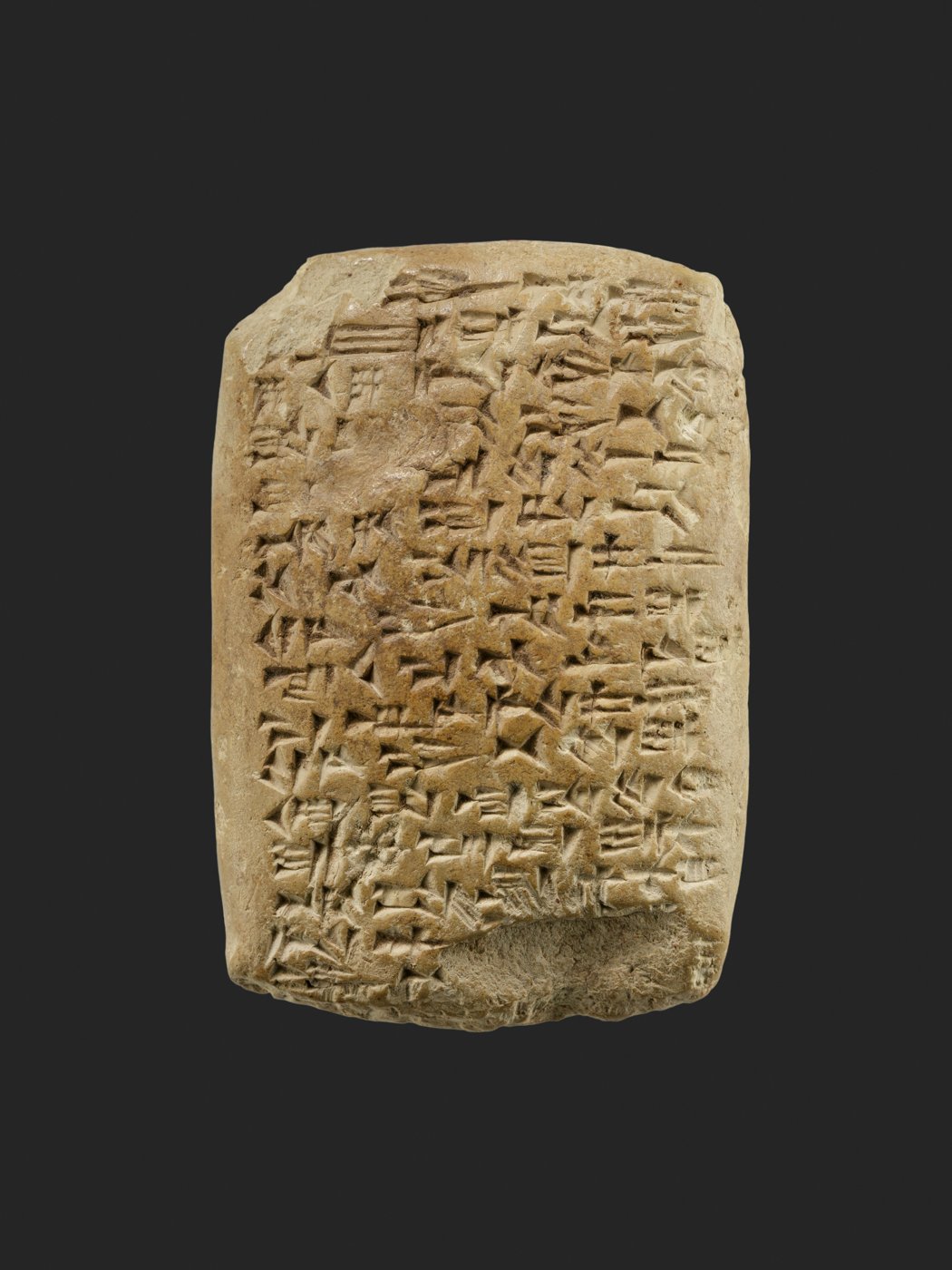
BackgroundAmarna letter EA 153 from Abi-milku, king of Tyre, to the king of Egypt. The Metropolitan Museum of Art, New York, Rogers Fund, 1924 (24.2.12), Public domain (The Met Open Access, CC0).
Now it came to pass, when Adonizedec king of Jerusalem had heard how Joshua had taken Ai, and had utterly destroyed it; as he had done to Jericho and her king, so he had done to Ai and her king; and how the inhabitants of Gibeon had made peace with Israel, and were among them;
Joshua 10:1, KJV
The Amarna letters are about 350 letters on clay tablets, found around 1887 at Amarna, the capital built by Pharaoh Akhenaten in Egypt. They are written in cuneiform (wedge-shaped marks pressed into clay), mostly in Akkadian, the language nations then used to write to each other. Many come from rulers of cities in Canaan who served Egypt, including Jerusalem, Gezer, Lachish, Megiddo, Shechem and Hazor, all named in the Book of Joshua (the Hazor entry describes the letters from its kings). Abdi-Heba, ruler of Jerusalem, begged Pharaoh for soldiers and complained in letter EA 286 that "the 'Apiru have plundered all the lands of the king."
Where it is today
Most are in the Vorderasiatisches Museum, Berlin (about 200 tablets, including Abdi-Heba's letter EA 286, VAT 1642), the British Museum, London (about 99), and the Egyptian Museum, Cairo (about 50). Smaller groups are in the Louvre, Paris, and other museums. The Metropolitan Museum of Art, New York, has 2 (24.2.11 and 24.2.12).
Date
The middle of the 1300s BC, over a span of 30 years or less, ending about 1332 BC.
Why this label: These are real letters that show Canaan as a land of small city-kingdoms under Egypt, with kings in places such as Jerusalem and Hazor, as Joshua describes. They do not name Israel or Joshua and do not prove the conquest.
Good to know: The word Habiru (also written Apiru or Hapiru) sounds like 'Hebrew', so early scholars equated the two, and some early-date writers (conquest about 1406 BC) have read Abdi-Heba's complaints about the Habiru as Canaan's side of Israel's struggles in the land. On that dating the letters come about 45 to 75 years after Israel entered Canaan, after Joshua's time. Most scholars now see the Habiru as a class of people on the edges of society, not one nation: the word appears in hundreds of documents over about 600 years (1700s to 1100s BC), from Egypt to Turkey and Iraq, for rebels, raiders, hired soldiers, servants and labourers whose names come from several languages. Many think any link to the Hebrews is indirect, for example that some early Israelites came from such groups, and some deny any link to the word 'Hebrew' at all. On the late date (1200s BC), the letters come from about a century before Israel arrived and show the land it entered.
Gibeon (el-Jib): the town named on its own jar handles
Joshua 9:3 · Joshua 10:2 · 2 Samuel 2:13
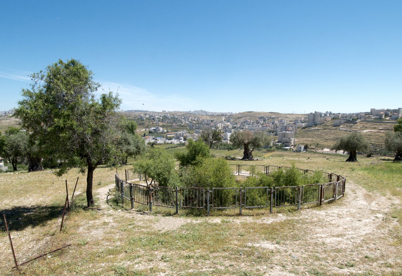
ConfirmedThe fenced site of the rock-cut pool at el-Jib (Gibeon), now overgrown with bushes, with the modern village behind. Natritmeyer, via Wikimedia Commons, CC BY-SA 4.0.
That they feared greatly, because Gibeon was a great city, as one of the royal cities, and because it was greater than Ai, and all the men thereof were mighty.
Joshua 10:2, KJV
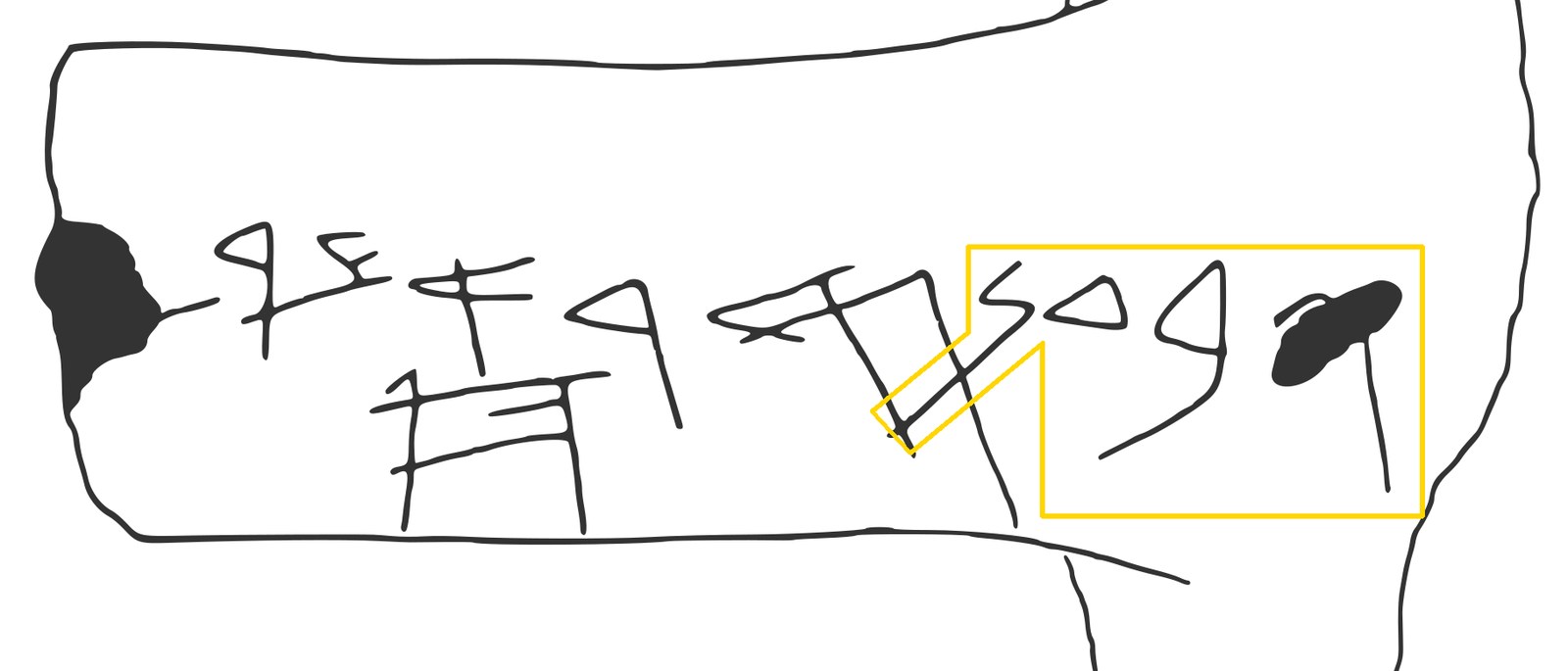
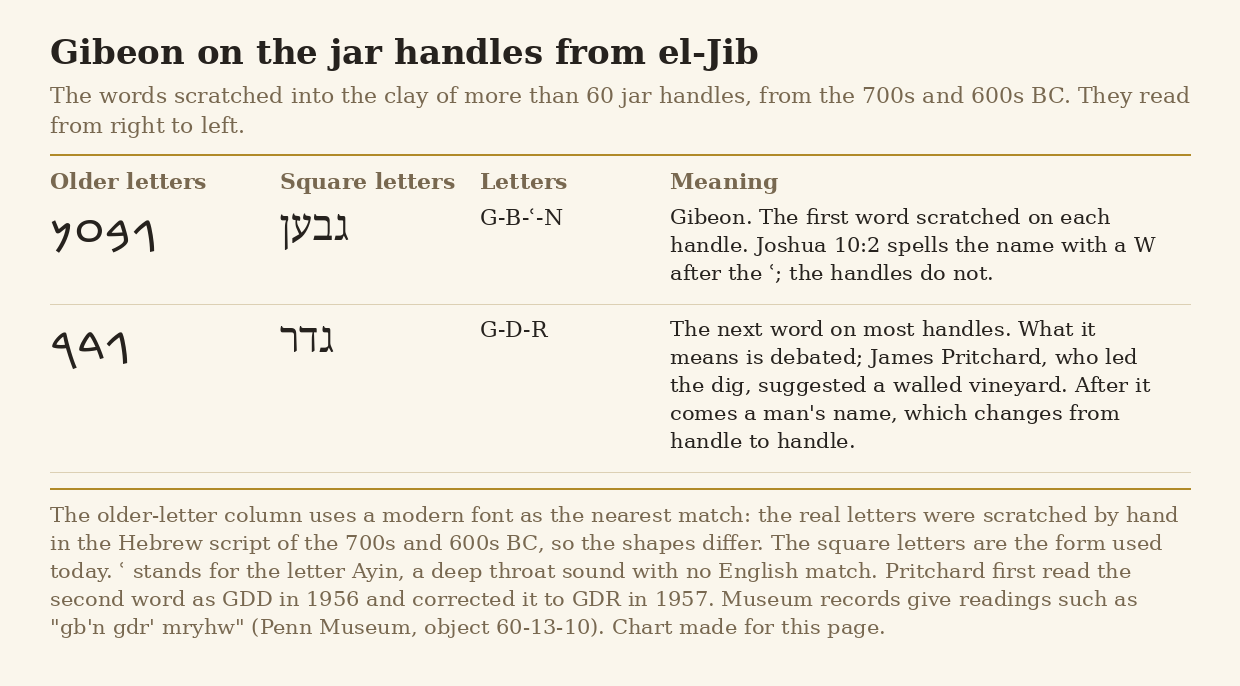
In Joshua 9 the people of Gibeon tricked Israel into a peace treaty, and in Joshua 10 Joshua defended them on the day he asked the sun to stand still upon Gibeon. Gibeon is the village of el-Jib, about 9 kilometres north of Jerusalem. In digs led by James Pritchard of the University of Pennsylvania from 1956, workers found more than 60 clay jar handles marked in old Hebrew letters with the name gb'n, 'Gibeon', most of them in the rubble that filled a huge pool cut into the rock. The pool is 11.3 metres across and 10.8 metres deep, with 79 steps cut in a spiral down its side and a tunnel going on down to a water chamber; it may be 'the pool of Gibeon' of 2 Samuel 2:13, though that cannot be proven. The sketch and chart below show the name Gibeon as it was scratched on the jar handles.
A modern sketch, not a photograph: jar handle inscription number 61 from el-Jib (Gibeon), drawn by the Wikipedia editor Onceinawhile in 2022. The yellow outline, added for this page, marks the first word, gb'n, "Gibeon", 4 letters read from right to left. The outline bends to follow the long tail of the last letter, N, which crosses a stroke of the next word. No free photo of an inscribed handle could be found. Sketch by Onceinawhile, via Wikimedia Commons, CC BY-SA 4.0.The words scratched on the Gibeon jar handles, gb'n ("Gibeon") and gdr, in a modern font of older Hebrew letters and in today's square letters, with notes on spelling and meaning. Chart made for this page, free to reuse.
Where it is today
el-Jib, about 9 kilometres north of Jerusalem, in the West Bank; the pool is at the site. Access can change, so check before planning a visit. The inscribed jar handles are divided between the Penn Museum, Philadelphia, and the Jordan Archaeological Museum, Amman.
Date
The pool was cut in the Iron Age, after about 1200 BC. The inscribed handles date from the 700s and 600s BC and come from debris left when the town was destroyed about 600 BC. Both are later than Joshua's time on either the early or the late date.
Why this label: Jar handles inscribed 'Gibeon' were found at el-Jib, so scholars agree that el-Jib is Gibeon. This confirms the place, not the events of Joshua 9 and 10: the handles are centuries later, and the pool is also later than Joshua.
Good to know: Pritchard found no trace of a town from the Late Bronze Age (about 1550 to 1200 BC), the time of the conquest on both the early date (about 1406 BC) and the late date (1200s BC). Only a few tombs from that age were found, some with imported pottery, and some of them were older tombs being used again. Pritchard himself suggested that the 'great city' of Joshua might lie in a part of the hill he did not dig. For scholars who doubt a single conquest, the missing town is a problem for the story as history.
The Jordan stopped 'at the city Adam' (Tell ed-Damiyeh)
Joshua 3:15 · Joshua 3:16 · Psalm 114:3
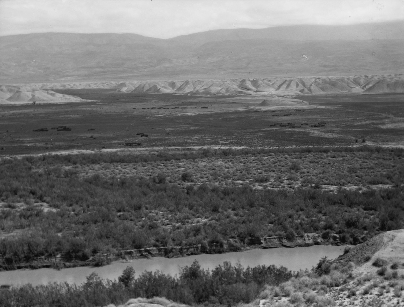
BackgroundThe Jordan River in the valley at Tell Damieh, near where the Jabbok joins it, photographed between about 1920 and 1933. G. Eric and Edith Matson Photograph Collection, Library of Congress Prints and Photographs Division, LC-DIG-matpc-15251, No known restrictions on publication (Library of Congress statement).
That the waters which came down from above stood and rose up upon an heap very far from the city Adam, that is beside Zaretan: and those that came down toward the sea of the plain, even the salt sea, failed, and were cut off: and the people passed over right against Jericho.
Joshua 3:16, KJV
Joshua 3 says that when the priests carrying the ark stepped into the Jordan at flood time, the water coming down from upstream stood up in a heap far away at the city Adam, and the people crossed opposite Jericho. Most scholars identify Adam with Tell ed-Damiyeh (also spelled Tall Damiyah), a small mound 500 metres east of the Jordan, just south of where the Jabbok (Zarqa) River joins it, about 30 kilometres upstream from Jericho. Here the Jordan runs between high, soft banks that can slide into the river. Later records tell of times when the river was blocked near here and ran dry downstream for a while.
Where it is today
Tell ed-Damiyeh is near the Damiya bridge on the east side of the Jordan River, in Jordan. A Dutch and Jordanian team (the Dutch National Museum of Antiquities in Leiden and Yarmouk University) dug there in 2004 and 2005 and again from 2012.
Date
People lived on the mound mainly from about the 1300s BC to the 500s BC, most of all in the Iron Age; later there were only storage pits and graves. River blockages reported near here: AD 1266 or 1267, 1546, and 1927 (the 1927 report is questioned).
Why this label: The mound is real and is probably the Adam of Joshua 3:16, though this rests on its name and location, and its small size has raised some doubt. The later blockages show the kind of event that can happen here; they do not prove or explain Israel's crossing.
Good to know: In the 1260s (AD 1266 or 1267; sources differ) the Arab historian al-Nuwayri recorded that the river bank near Damiya fell into the Jordan and the river below ran dry. John Garstang reported that the 1927 earthquake made the banks fall about 20 kilometres north of Jericho and dammed the river for 21 hours, but a 2002 study by Avni and others questioned this: the daily police reports of the time did not mention it, and Garstang was not in the country then. Some Christian writers suggest God may have used such a landslide and say the timing would still make it a miracle; the Bible presents the crossing as a miracle done by God (Joshua 3:13; 4:23), and no trace of a landslide from Joshua's time has been found. The KJV reads 'very far from the city Adam', while the NASB reads 'a great distance away at Adam'.
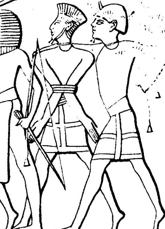
ConfirmedA line drawing of part of the Medinet Habu carving, showing Sea Peoples prisoners; the man in the centre wears the feathered headdress linked to the Peleset (Philistines). Drawing by Oltau, via Wikimedia Commons, CC BY-SA 4.0.
And the children of Israel did evil again in the sight of the LORD; and the LORD delivered them into the hand of the Philistines forty years.
Judges 13:1, KJV
The Philistines were Israel's main enemy in the days of the judges, from Shamgar to Samson. Egyptian texts name a people called the Peleset, and most historians agree these are the Philistines. Carvings and texts on the temple of Ramesses the Third at Medinet Habu in Egypt describe his war against the "Sea Peoples" in his 8th year, about 1175 BC, and the text lists the Peleset among them. Digs at Ashkelon, Ashdod, Ekron and Gath have found the Philistines' own painted pottery, first pottery made locally in the style of Mycenaean Greek pottery, and later red and black painted pottery called "Philistine Bichrome" (two-colour) ware.
Where it is today
Medinet Habu temple, on the west bank of the Nile at Luxor, Egypt. The Philistine city mounds are in Israel: Ashkelon on the coast, Tel Ashdod, Tel Miqne (Ekron) and Tell es-Safi (Gath, now Tel Tzafit national park). Ancient Gaza lies under the modern city and has hardly been dug. Philistine pottery can be seen in Israeli museums, such as the Corinne Mamane Museum of Philistine Culture in Ashdod.
Date
Medinet Habu record: 8th year of Ramesses the Third, about 1175 BC (he is usually dated 1186 to 1155 BC). Philistine settlement in Canaan: from the 1100s BC. Philistine Bichrome pottery: early Iron Age, about 1200 to 1000 BC.
Why this label: The Philistines are named in Egyptian and later Assyrian records, and their cities and goods have been dug up, so the people and their main cities are clearly the ones the Bible names. The site of Ekron (Tel Miqne) is confirmed by a stone inscription found there in 1996 that names the city. The site of Gath (Tell es-Safi) is accepted by most scholars from its location and finds, not from an inscription naming the city.
Good to know: In 2019 a team led by Michal Feldman of the Max Planck Institute studied DNA from 10 people buried at Ashkelon and found that people from the early Iron Age had some European-related ancestry that the earlier Bronze Age people did not have, which fits a movement of people from across the Mediterranean. Within about 200 years this trace had mixed into the local population, and the study pointed to southern Europe in general but could not name an exact homeland. The Bible says the Philistines came from Caphtor (Amos 9:7), a Bronze Age name usually taken to mean Crete.
BackgroundThe main temple at Tell Qasile, with the two round stone pillar bases in the centre. Wikimedia Commons user Ori~, CC BY-SA 3.0.
And Samson took hold of the two middle pillars upon which the house stood, and on which it was borne up, of the one with his right hand, and of the other with his left.
Judges 16:29, KJV
Judges 16 says Samson died in the temple of Dagon at Gaza by pulling on "the two middle pillars" that held up the building, one with each hand. The Gaza temple has never been found, but two Philistine temples with this plan have been dug up. At Tell Qasile in Tel Aviv, Amihai Mazar found a temple whose main hall had its roof held up by two wooden pillars standing on round stone bases about 2 metres apart. At Tell es-Safi (Gath), Aren Maeir's team found a temple with two central pillars in 2010, and Maeir said it may show "that the story of Samson reflects a type of temple that was in use in Philistia at the time."
Where it is today
Tell Qasile: inside the grounds of the Eretz Israel Museum, Tel Aviv, Israel, where the two pillar bases were left in place for visitors. Tell es-Safi (Gath): Tel Tzafit national park, between Ashkelon and Beit Shemesh, Israel.
Date
Tell Qasile: the Philistine town was founded in the 1100s BC; the two-pillar temple is usually dated to the 1000s BC. Gath: Iron Age, dated by the excavators in 2010 to about the 900s BC.
Why this label: These temples show that the Bible's picture of a Philistine temple held up by two central pillars, close enough for one man to reach both, matches real Philistine buildings. They do not name Samson or Dagon, and neither one is the Gaza temple in the story.
Good to know: The pillars were wooden posts standing on stone bases. Writers who accept the story as history point out that such posts were held in place mainly by the weight of the roof, so a strong man could push them off their bases; the story does not need stone columns to break. The Tell Qasile temple is small, about 8 by 14.5 metres, far too small to hold the 3,000 people that Judges 16:27 puts on the roof at Gaza, so it shows a type of building, not the size of Dagon's house. Some scholars treat the Samson story as a folk tale; these finds show that the kind of building in the story was real, but they cannot prove the event itself.
The fortress temple at Shechem (house of Baal-berith?)
Judges 9:4 · Judges 9:46-49 · Joshua 24:26
DisputedView from above of the excavated area at Tell Balata (Shechem); the stone platform at left, with a pale standing stone in front of it, is the temple area. Yair Dov, via Wikimedia Commons, CC BY-SA 4.0.
And when all the men of the tower of Shechem heard that, they entered into an hold of the house of the god Berith.
Judges 9:46, KJV
Judges 9 tells how Abimelech, son of Gideon, was given 70 pieces of silver from "the house of Baalberith" at Shechem to hire men, and later burned about 1,000 people who had taken shelter in the stronghold of "the house of the god Berith". At Tell Balata (Shechem), Ernst Sellin's German team (1913 to 1914 and 1926 to 1934) and G. Ernest Wright's American team (1956 to 1964) uncovered a huge temple about 21 by 26 metres, with walls about 5 metres thick and towers beside the entrance. It is called a "fortress temple" or "migdal" (tower) temple, and it is one of the largest temples known from Canaan. In its courtyard were an altar and a large standing stone, which still stands there, broken, today.
Where it is today
Tell Balata, on the eastern edge of Nablus, in the West Bank. The temple foundations and the broken standing stone can still be seen. Access is limited, so check before planning a visit.
Date
Built about 1650 BC (Middle Bronze Age). Wright's team held that it was destroyed about 1550 BC and replaced on the same spot about 1450 BC by a smaller temple that lasted until about 1100 BC. The excavators dated the destruction of the early Iron Age city to about 1125 to 1100 BC.
Why this label: Shechem is broadly accepted as Tell Balata (see the Genesis page), and the temple is real. Whether this building is the "house of Baal-berith" of Judges 9 is debated, because the dating of its later phases, and of any destruction in the time of the judges, is disputed.
Good to know: Lawrence Stager argued in 2003 that the great fortress temple itself stayed in use into the time of the judges and is the temple of Judges 9, and the Associates for Biblical Research agree; the American excavators had thought the great temple was used only from about 1650 to 1550 BC. Lawrence Toombs, one of those American excavators, wrote that the violent end of the early Iron Age city is "almost certainly" to be explained by Abimelech's attack. The New Catholic Encyclopedia says there is "no clear evidence of a destruction of the temple itself in the Early Iron Age." Some link the standing stone to the "great stone" Joshua set up at Shechem (Joshua 24:26), but nothing written on it or found with it proves this.
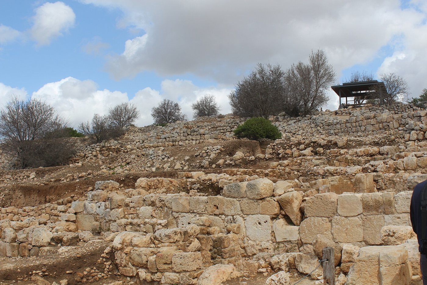
ConfirmedExcavated stone walls on the slope of Tel Shiloh, with a shade shelter on the top. Deror Avi, via Wikimedia Commons, CC BY-SA 4.0.
Then they said, Behold, there is a feast of the LORD in Shiloh yearly in a place which is on the north side of Beth-el, on the east side of the highway that goeth up from Beth-el to Shechem, and on the south of Lebonah.
Judges 21:19, KJV
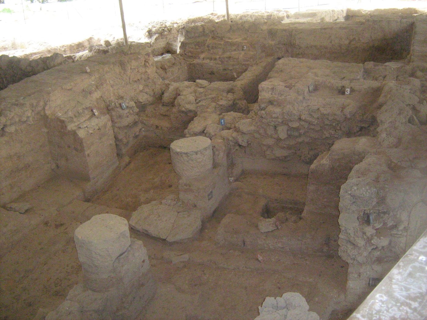
In Judges and 1 Samuel, Shiloh is where the tabernacle stood and where Eli served and Samuel grew up, until the ark was lost to the Philistines (1 Samuel 4). Judges 21:19 gives unusually exact directions: north of Beth-el, east of the road from Beth-el to Shechem, and south of Lebonah, and the mound of Khirbet Seilun fits them. It was dug by a Danish team (1926 to 1932, with a probe in 1963), by Israel Finkelstein of Bar-Ilan University (1981 to 1984), and since 2017 by Scott Stripling for the Associates for Biblical Research. Finds include a Middle Bronze Age city, Late Bronze Age offering remains, and an early Iron Age town with large pillared storerooms, storage jars and grain silos that was destroyed by fire in the 1000s BC.
Where it is today
Tel Shiloh (Khirbet Seilun), about 31 kilometres north of Jerusalem in the hill country north of Beth-el, in the West Bank. It is an archaeological park with a visitor centre. Access is limited, so check before planning a visit.
Date
Middle Bronze Age city; Israelite town in the early Iron Age (about 1200 to 1050 BC); burned in the second half of the 1000s BC by radiocarbon dating, about 1050 BC by Finkelstein's dating.
Why this label: Scholars broadly agree Khirbet Seilun is Shiloh, because it matches the directions in Judges 21:19 and its Arabic name, Seilun, keeps the old name; no inscription naming the town has been found there. Claims about where the tabernacle stood are a separate matter and are not settled.
Good to know: Stripling reports a large building lined up east to west and divided into two parts, one twice the size of the other, as the tabernacle was. He also reports a pottery pomegranate and many animal bones, mostly from the right side, which he links to the priests' share in Leviticus 7:32. He has said he cannot yet be certain the tabernacle stood there, and his final results are not yet published. Finkelstein, who dug there in the 1980s, agrees there was long religious activity at the site but says the nature and exact place of the shrine are "not very clear." The two men also disagree on whether the earlier Late Bronze Age offerings were Canaanite or Israelite, which depends on when one dates Israel's arrival in Canaan.
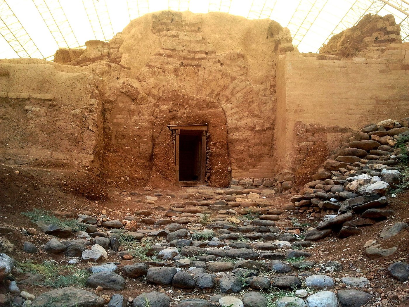
ConfirmedThe restored Middle Bronze Age mud-brick gate at Tel Dan, under its modern protective roof. Hanay, via Wikimedia Commons, CC BY-SA 3.0.
And they called the name of the city Dan, after the name of Dan their father, who was born unto Israel: howbeit the name of the city was Laish at the first.
Judges 18:29, KJV
Judges 18 tells how the tribe of Dan burned the quiet town of Laish, rebuilt it, renamed it Dan and set up Micah's carved image there; later Jeroboam the First put one of his golden calves at Dan (1 Kings 12:29). Tel Dan, at the springs of the Jordan in northern Israel, was dug by Avraham Biran for 33 seasons starting in 1966. Finds include a mud-brick city gate with three complete arches from about 1750 BC, often called "Abraham's Gate", and a large sacred area (a "high place") that Biran linked to Jeroboam. After the Late Bronze Age city ended around 1200 BC, the next layer has many grain pits and simple remains, which Biran took to be the first Danite settlers.
Where it is today
Tel Dan Nature Reserve, in the Hula Valley of northern Israel, near Kibbutz Dan. The restored Middle Bronze Age gate, the Israelite gates and the high place can be visited.
Date
Arched mud-brick gate: about 1750 BC (Middle Bronze Age). Late Bronze Age city ended in the late 1200s or early 1100s BC, followed by the early Iron Age pit settlement. High place: from the time of Jeroboam the First (late 900s BC) onward. The city was burned some time after 750 BC, probably by an Assyrian army; many link this to Tiglath-pileser the Third's campaign of 733 or 732 BC, though no ancient record names Dan as one of his conquests.
Why this label: The site's Arabic name, Tell el-Qadi ("mound of the judge"), translates the name Dan, and a Greek and Aramaic inscription found in the sanctuary is a vow "to the god who is in Dan", so the identification is secure. Linking the pit layer to the tribe of Dan is the excavator's reading, since the pits themselves carry no names.
Good to know: "Abraham's Gate" is a modern nickname taken from Genesis 14:14, where Abram chased the kings "unto Dan"; nothing found at the gate connects it to Abraham. Laish also appears in a list of towns conquered by the pharaoh Thutmose the Third in the 1400s BC. The Tel Dan Stele, which mentions the "House of David", was also found here and is covered on a later page.
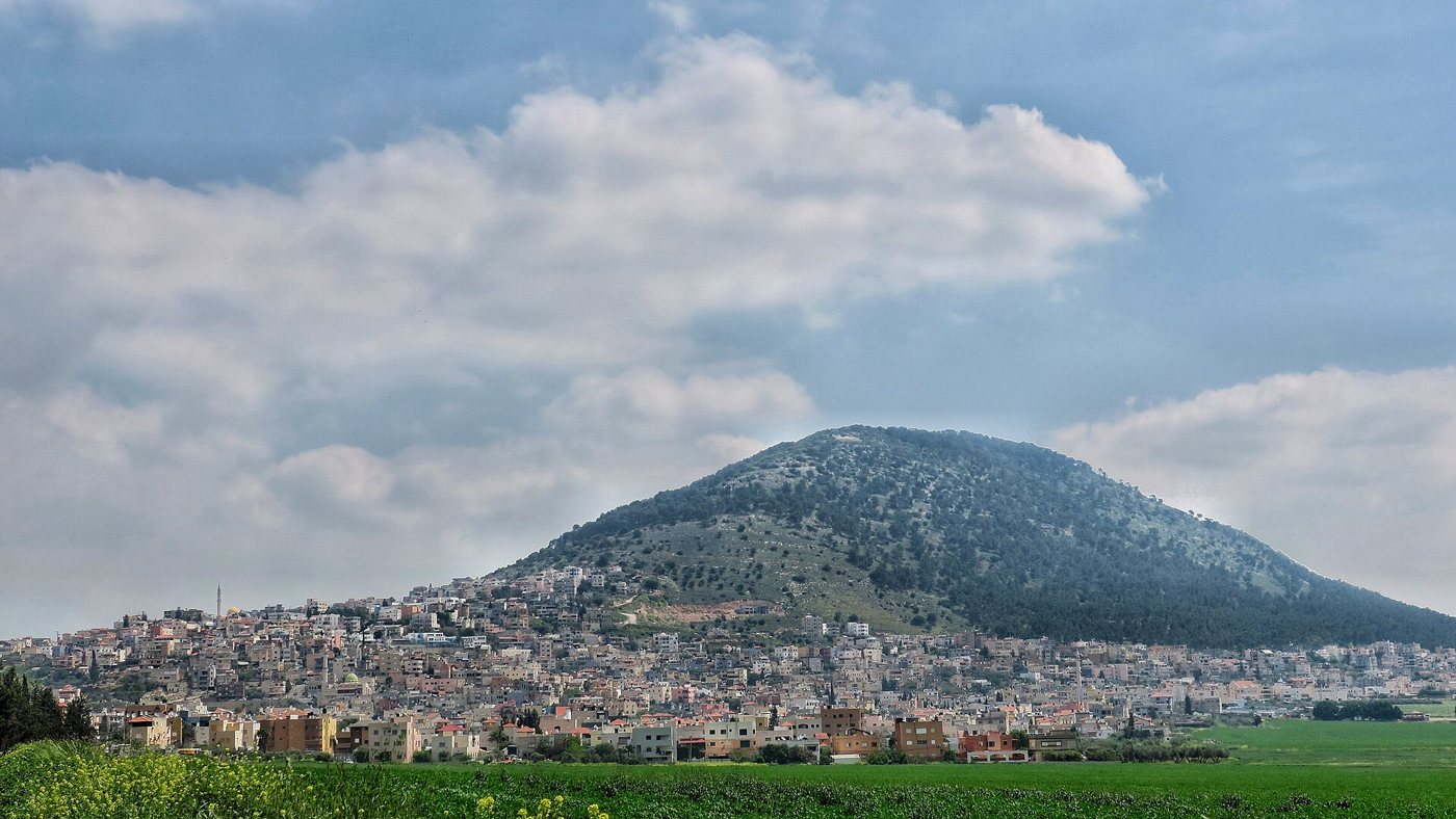
ConfirmedMount Tabor rising above the plain, with a town at its foot. Noamdahary, via Wikimedia Commons, CC BY-SA 4.0.
And Deborah said unto Barak, Up; for this is the day in which the LORD hath delivered Sisera into thine hand: is not the LORD gone out before thee? So Barak went down from mount Tabor, and ten thousand men after him.
Judges 4:14, KJV
Deborah sent Barak to gather 10,000 men on Mount Tabor, and from there they charged down against Sisera's army (Judges 4). Mount Tabor is a lone, rounded hill about 575 metres high at the eastern end of the Jezreel Valley in Lower Galilee. It rises sharply above the flat land around it and overlooks an old road junction, which made it a good place to gather an army.
Where it is today
Lower Galilee, northern Israel, about 17 kilometres west of the Sea of Galilee. A road climbs to the top, where there are churches and a monastery.
Date
A natural landmark, named in the Bible from Joshua 19:22 onward. Barak's battle is set in the period of the judges.
Why this label: Scholars broadly agree that this is the Bible's Mount Tabor. The name has lasted: the Jewish historian Josephus (first century AD) and some books of the old Greek translation of the Old Testament call it Itabyrion, and in Arabic it is Jabal Tabur. It also fits the Bible's own description as a landmark on the borders of Zebulun, Issachar and Naphtali (Joshua 19:12, 22 and 34). No inscription naming it has been found there, no object from Barak's battle has been found, and the exact battle places are not known.
Good to know: The churches on top mark a later Christian tradition that Jesus was transfigured here. That tradition goes back to Origen in the 200s AD, but the Gospels do not name the mountain and many scholars prefer Mount Hermon, so it is separate from the firm identification of Barak's Mount Tabor.
Bethlehem named outside the Bible: the clay seal from Jerusalem
Ruth 1:19 · Ruth 4:11 · Micah 5:2
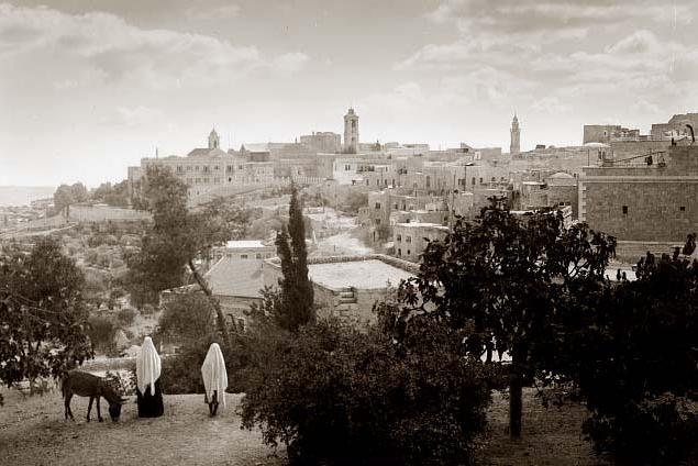
ConfirmedView of the town of Bethlehem in 1898. Unknown photographer, 1898, via Wikimedia Commons, Public domain.
So they two went until they came to Bethlehem. And it came to pass, when they were come to Bethlehem, that all the city was moved about them, and they said, Is this Naomi?
Ruth 1:19, KJV
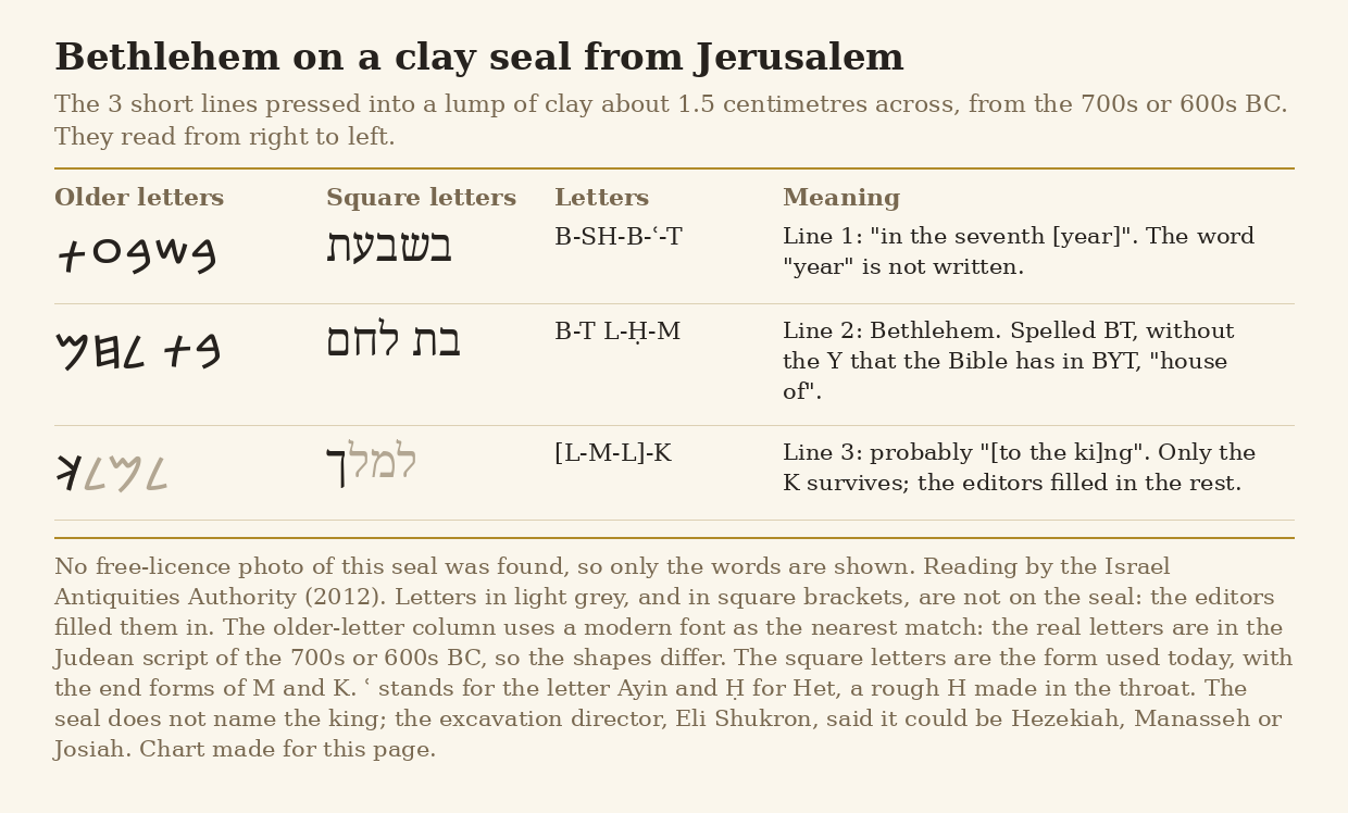
In 2012 a small lump of clay about 1.5 centimetres across was found while sifting soil dug out of the City of David excavation in Jerusalem. It had been pressed with a seal and carries 3 short lines of ancient Hebrew: "in the seventh [year]", "Bethlehem", and probably "[to the ki]ng" (only the last letter of this word survives; the rest is filled in by the editors). The excavation director, Eli Shukron of the Israel Antiquities Authority, explained it as a tax seal: a shipment of silver or farm goods sent from Bethlehem to the king in Jerusalem. It is the earliest certain mention of Bethlehem, the home town of Naomi, Boaz, Jesse and David, in writing outside the Bible. The chart below shows the 3 lines on the seal, including the name Bethlehem.
The 3 short lines on the clay seal from Jerusalem, with the name Bethlehem in the middle line, in a modern font of older Hebrew letters and in today's square letters. Letters in light grey are not on the seal and were filled in by the editors. No free photo of the seal could be found. Chart made for this page, free to reuse.
Where it is today
Held by the Israel Antiquities Authority (found in the City of David, Jerusalem). The town of Bethlehem lies about 10 kilometres south of Jerusalem. Access is limited, so check before planning a visit.
Date
Seal: late 700s or 600s BC, in the reign of a king of Judah (perhaps Hezekiah, Manasseh or Josiah). Possible earlier mention in the Amarna letters: about 1350 to 1330 BC.
Why this label: Scholars agree that the town of Bethlehem near Jerusalem is the Bethlehem of Ruth and David, and the name has been in use without a break. The clay seal shows Bethlehem was a town of Judah paying tax to the king, but it dates from several hundred years after the time of Ruth, and no inscription from Ruth's own time names the town.
Good to know: A letter from Abdi-Heba, ruler of Jerusalem, to Pharaoh (Amarna letter EA 290, about 1350 BC) complains that a town near Jerusalem went over to his enemies. Its name is written with signs that some scholars read as "Bit-Lahmi" (Bethlehem), but others read it as other towns, such as Beth-Shemesh or Beth-Horon, so this earlier mention is possible but not certain. Also, the Bible names a second Bethlehem in the north (Joshua 19:15), which is why Ruth 1:1 says "Bethlehemjudah".
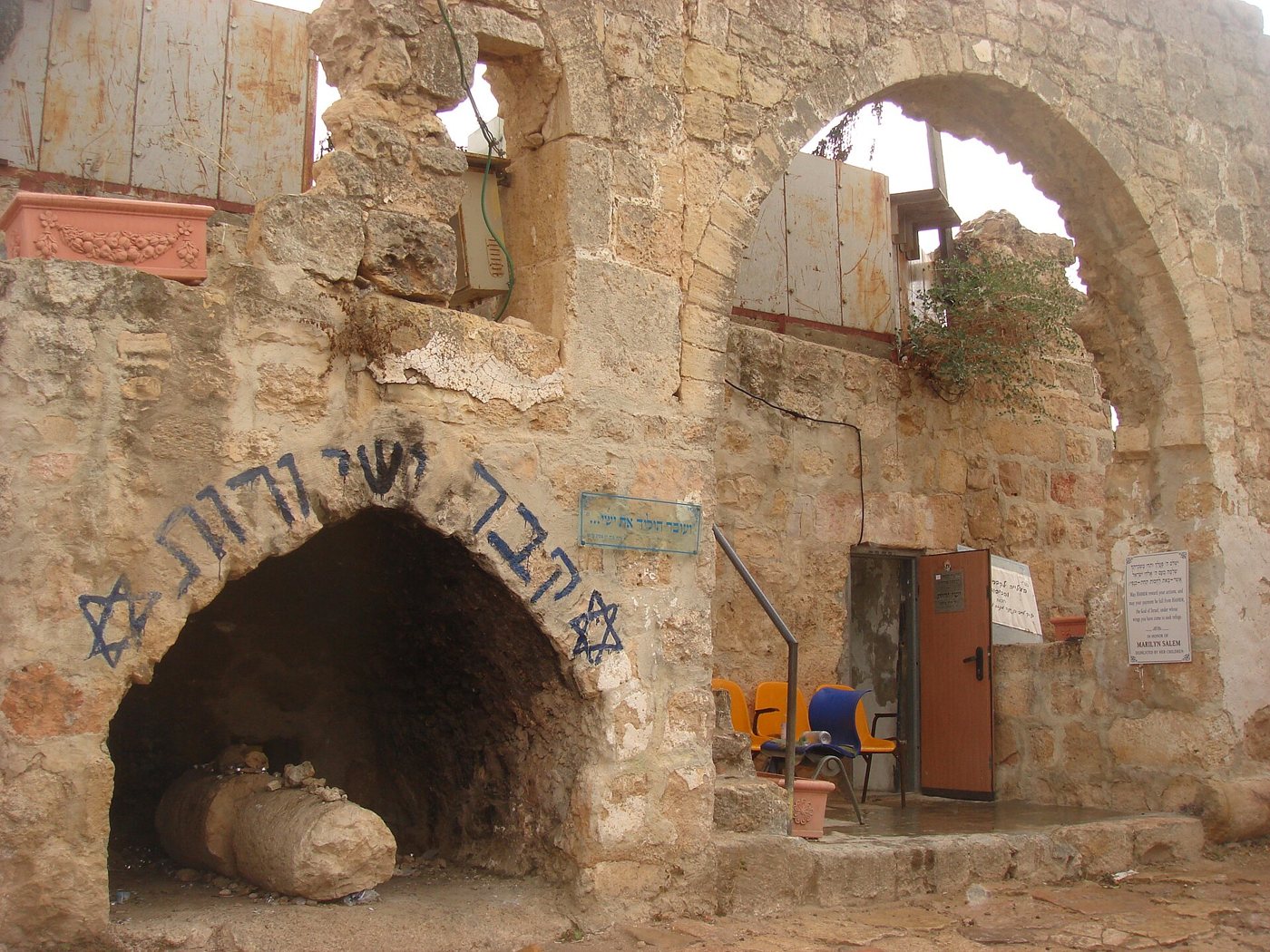
Traditional siteThe ruined Deir al-Arba'in building in Hebron, with the entrance to the tomb at lower left (2008). Original uploader on Hebrew Wikipedia, via Wikimedia Commons, Free to use with credit (Commons Attribution licence).
And the women her neighbours gave it a name, saying, There is a son born to Naomi; and they called his name Obed: he is the father of Jesse, the father of David.
Ruth 4:17, KJV
On the hill of Tel Rumeida in Hebron stands an old ruined building known in Arabic as Deir al-Arba'in. A burial cave in one corner is pointed out as the tomb of Jesse, David's father, and of Ruth, his grandmother, and a small synagogue room sits beside it. The Book of Ruth ends with the family line from Ruth and Boaz to Obed, Jesse and David (Ruth 4:17-22), which is why the site is visited, especially at the Jewish feast of Shavuot when Ruth is read.
Where it is today
Tel Rumeida, about 300 metres west of the Old City of Hebron. Access is limited, so check before planning a visit.
Date
Building: a ruin of uncertain date (the British survey of the 1870s called it later Arab work on older foundations). Tradition of Jesse's tomb: from the 1200s AD. Tradition of Ruth's tomb: from the early 1800s.
Why this label: The building is real and the tradition is several hundred years old, but no inscription or early record ties this cave to Jesse or Ruth. The Bible does not say where either of them was buried.
Good to know: One of the earliest Jewish travellers known to mention this hill was Rabbi Jacob, a messenger sent from Paris (about AD 1238 to 1244). He said either Jesse or Joab was buried there. Another traveller, in 1481, placed Jesse's tomb about 10 miles (about 16 kilometres) from Hebron. Ruth was first linked to the tomb only in the early 1800s, and a 1600s traveller called the same tomb Caleb's. The Bible ties Jesse and Ruth to Bethlehem, not Hebron, and 1 Samuel 22:3-4 says David took his parents to Moab for safety.
The Balu'a Stele: a ruler's monument from the land of Moab
Ruth 1:1 · Ruth 1:4 · Judges 3:12
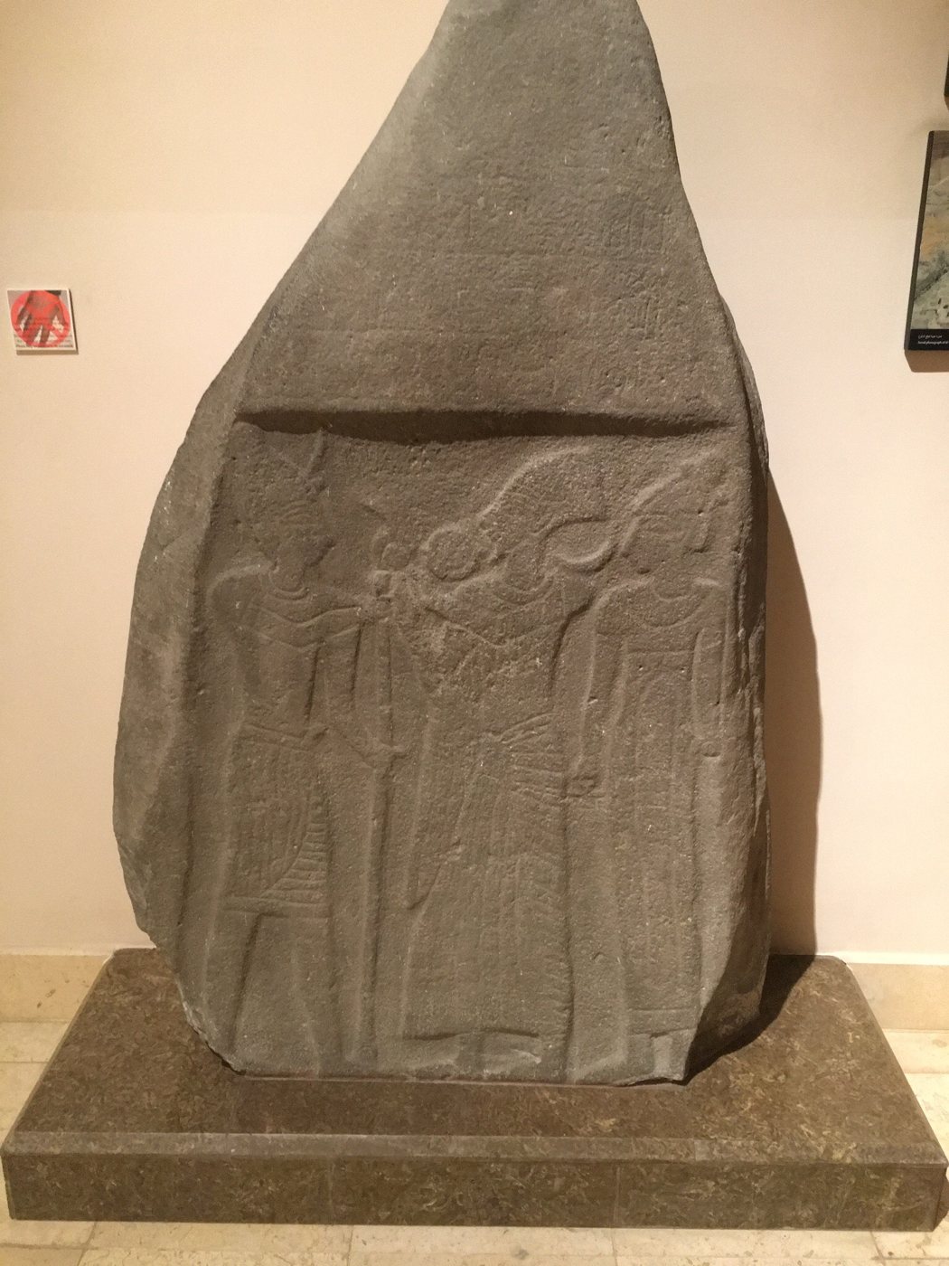
BackgroundThe Balu'a Stele on display at the Jordan Museum in Amman. Makeandtoss, via Wikimedia Commons, CC0.
Now it came to pass in the days when the judges ruled, that there was a famine in the land. And a certain man of Bethlehemjudah went to sojourn in the country of Moab, he, and his wife, and his two sons.
Ruth 1:1, KJV
The Balu'a Stele is a stele: a carved stone slab set up as a monument. It is made of basalt (a hard, dark volcanic stone), stands about 1.8 metres (6 feet) tall, and was found in 1930 at Khirbet al-Balu'a, north of Karak in Jordan, in the land the Bible calls Moab. Carved in Egyptian style, it shows a local ruler standing between two gods, which is usually explained as a scene of a ruler being given his royal power. It has a few lines of writing, but they are so worn that they can no longer be read, so we do not know the ruler's name or what he called his land. It shows that, some time between about 1300 and 1100 BC, a ruler in this area had himself shown in the Egyptian royal manner. That is roughly the period of the judges, when the Book of Ruth is set, on either dating.
Where it is today
The Jordan Museum, Amman, Jordan.
Date
About 1300 to 1100 BC (end of the Late Bronze Age or start of the Iron Age).
Why this label: The stele comes from the land of Moab and from roughly the time of the judges, but it does not name Moab, any Moabite or any person in Ruth. Experts say we cannot be sure the ruler shown was a Moabite.
Good to know: Egyptian records of Ramesses the Second may name Moab at about the same time or a little earlier, in the 1200s BC (see "Meanwhile in the world" at the start of this section). The well-known Mesha Stele, a Moabite king's inscription from about 840 BC, belongs to a later period and is covered on the kings page.
 LearnAboutHim