Real places you can visit and real objects you can see in museums, connected to the book of Genesis. Each one is marked honestly, so you can tell solid evidence from tradition and from claims that are still argued over.
ConfirmedThe place or object is real and is clearly the one the Bible names.9
Traditional siteA real place that long tradition links to the Bible, but the exact spot cannot be proven.6
DisputedInformed people disagree, or the claim rests on weak evidence.7
BackgroundShows the world the Bible describes, but does not name a Bible person or event.7
Creation to the Flood
1
The Tigris and Euphrates rivers
Genesis 2:10 · Genesis 2:14 · Daniel 10:4
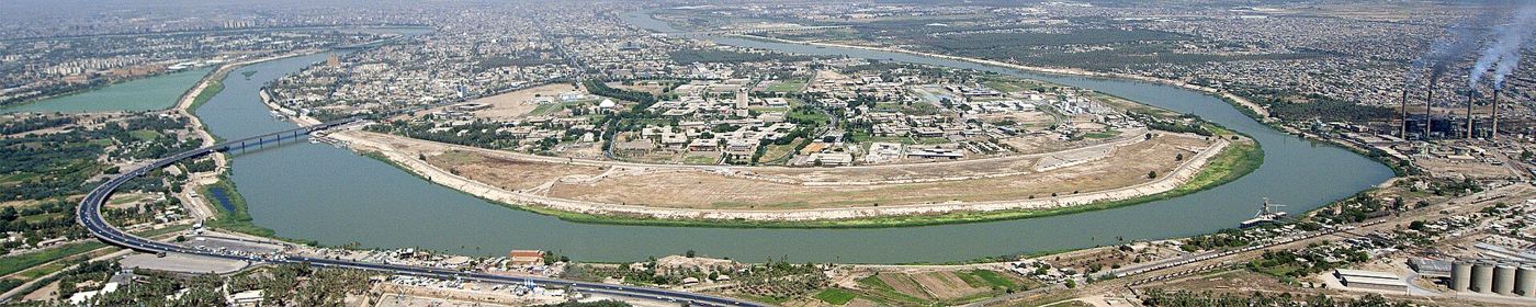
ConfirmedThe Tigris River at Baghdad, seen from the air in 2016. US Department of Defense, Office of the Chairman of the Joint Chiefs of Staff, CC BY 2.0.
And the name of the third river is Hiddekel: that is it which goeth toward the east of Assyria. And the fourth river is Euphrates.
Genesis 2:14, KJV
Genesis 2 says a river went out of Eden and split into four rivers. Two of them are the Hiddekel and the Euphrates. Hiddekel is the Hebrew name of the Tigris. Daniel 10:4 uses the same name for the great river where Daniel was standing when he saw a vision. Both rivers still flow today. They start in the mountains of eastern Turkey and run down through Iraq. The Euphrates also crosses Syria, and the Tigris runs along the Syrian border for a short stretch.
Where it is today
Turkey, Syria and Iraq. The Tigris passes Mosul and Baghdad. The two rivers join near al-Qurnah in southern Iraq to form the Shatt al-Arab, which flows into the Persian Gulf.
Date
Natural rivers, much older than any written record. The Tigris is about 1,750 to 1,900 km long, depending on how it is measured.
Why this label: The Tigris and Euphrates are real rivers, and the Hebrew name Hiddekel is the Tigris (in Akkadian, the old language of Assyria and Babylon, it was Idiqlat). This label covers the rivers only, not the place of Eden.
Good to know: No one knows where the Garden of Eden was. The other two rivers in Genesis 2, the Pison and the Gihon (KJV spelling), have not been identified for certain. Places that have been suggested, such as the head of the Persian Gulf or the mountains of eastern Turkey, remain unproven. Some Bible-believing writers, such as Creation Ministries International, hold that the worldwide Flood reshaped the land. In their view, today's Tigris and Euphrates were named after the rivers of Eden but do not follow the same courses.
The mountains of Ararat and Mount Ararat (Agri Dagi)
Genesis 8:4 · 2 Kings 19:37 · Jeremiah 51:27
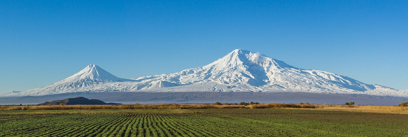
DisputedMount Ararat (right) and Little Ararat (left), seen from the Ararat plain. Սէրուժ Ուրիշեան (Serouj Ourishian), CC BY-SA 4.0.
And the ark rested in the seventh month, on the seventeenth day of the month, upon the mountains of Ararat.
Genesis 8:4, KJV
Genesis 8:4 says the ark rested "upon the mountains of Ararat". Ararat is the Hebrew name of a land. The Assyrians called it Urartu. It was a kingdom around Lake Van in eastern Turkey, and it reached into nearby Armenia. So the Bible names a mountain region, not one peak. The tall volcano now called Mount Ararat (Agri Dagi in Turkish) stands in that region. It is the best-known suggested landing site.
Where it is today
Eastern Turkey, between Agri and Igdir provinces, near the borders of Armenia, Iran and Nakhchivan (Azerbaijan). The main peak rises to 5,137 metres. It is clearly seen from Yerevan, Armenia.
Date
The name Urartu appears in Assyrian records from the 1200s BC, and the kingdom came to an end in the 500s BC. Armenians linked the ark to this peak from about the AD 1000s. In European writing, the earliest known link is usually said to be by William of Rubruck, a traveller in the AD 1200s.
Why this label: The region of Ararat is real, but Genesis does not say which mountain in it. Linking the ark to this one peak is a tradition from the Middle Ages, and no ark remains have been confirmed there.
Good to know: The same Hebrew name, Ararat, is used in 2 Kings 19:37 and Isaiah 37:38 for the land where Sennacherib's sons fled. The KJV there says "the land of Armenia". The local peoples did not traditionally call this peak Ararat. Armenians traditionally called it Masis, and today they use both Masis and Ararat. Europeans began calling it Ararat in the Middle Ages.
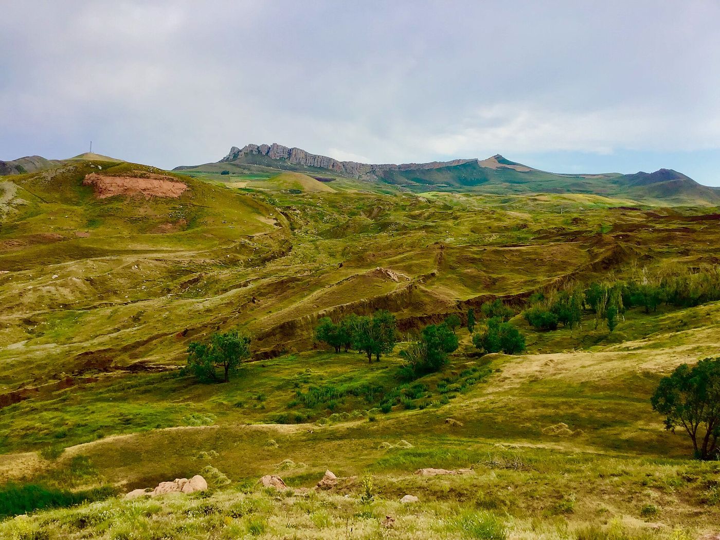
DisputedThe Durupinar site and the hills around it, July 2019. Wikkiwooki, CC BY-SA 4.0.
And the ark rested in the seventh month, on the seventeenth day of the month, upon the mountains of Ararat.
Genesis 8:4, KJV
The Durupinar formation is a boat-shaped mound of earth and rock about 164 metres long, on the slopes of Mount Tendurek, roughly 30 km south of Mount Ararat. A Turkish army captain, Ilhan Durupinar, spotted it on an aerial photo in 1959. Ron Wyatt, an amateur explorer, promoted it as Noah's ark from 1977 onward. A 1960 dig at the site found only soil and rocks.
Where it is today
Near the village of Uzengili, about 16 km southeast of Dogubayazit and about 3 km from the Iran border, eastern Turkey. It lies at about 2,000 metres above sea level.
Date
The mound itself has not been reliably dated. Local reports say heavy rain and earthquakes uncovered it in 1948. It was spotted on an aerial photo in 1959.
Why this label: Geologists who have studied the site, including the young-earth creationist geologist Andrew Snelling, say it is a natural rock formation, not a boat. The case for an ark rests on its shape and on test results that news reports describe without citing a published, expert-checked paper.
Good to know
The promoters: A team from Istanbul Technical University, Agri Ibrahim Cecen University and Andrews University (USA) tested nearly 30 soil and rock samples. At a 2023 conference it reported clay, sea shells and an age of about 3,500 to 5,000 years. News reports of this work cite no paper that other experts checked before it was published, and a soil age by itself does not show that a boat was there.
The critics: Many geologists think the mound is natural. A 1996 paper by geologist Lorence Collins and David Fasold, who had earlier promoted the site, and a 2025 report by Turkish geological engineer Esref Atabey both concluded it is a natural formation.
Latest work: A new team drilled into the mound from July to September 2026 and sent samples to several universities. The team says none of its holes, up to about 20 metres deep, reached a solid layer of rock, which it argues a natural rock formation would have; it does not claim proof. A final report is expected in spring 2027.
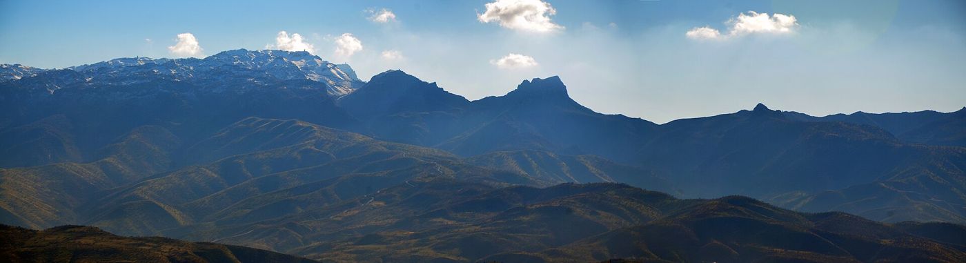
DisputedMount Cudi (Judi) in southeastern Turkey. KediÇobanı, CC BY-SA 4.0.
And the ark rested in the seventh month, on the seventeenth day of the month, upon the mountains of Ararat.
Genesis 8:4, KJV
Mount Judi is a mountain in southeastern Turkey, near the Tigris and the borders of Syria and Iraq. It lies in the old district the Greeks and Romans called Gordyene (Corduene). The Jewish historian Josephus (first century AD) quotes the Babylonian writer Berossus, who wrote about 280 BC (William Whiston's translation): "It is said there is still some part of this ship in Armenia, at the mountain of the Cordyaeans; and that some people carry off pieces of the bitumen". Syriac Christian tradition placed the ark here, and the Quran (11:44) says the ark rested on "al-Judi".
Where it is today
Sirnak Province, southeastern Turkey, northeast of the town of Cizre. Highest point about 2,089 metres.
Date
Berossus wrote about 280 BC. His words survive because Josephus quoted them in the first century AD. Syriac Christian tradition linked the ark with this mountain through late ancient times. The shift to today's Mount Ararat came in the Middle Ages.
Why this label: This is one of the oldest landing-site traditions, but Berossus placed the ship only "at the mountain of the Cordyaeans", without naming a peak. Later Syriac and Islamic writers named Mount Judi itself. It is tradition, the Bible does not name this mountain, and ancient writers did not agree.
Good to know: Josephus also says the Armenians called the landing place the "Place of Descent" and still showed remains there. Some link that place with Nakhchivan, a town about 100 km southeast of Mount Ararat, not with Mount Judi. Two ancient translations of Genesis 8:4, the Targum Onkelos (an early Jewish translation into Aramaic) and the Syriac Bible, put "Qardu" (Kardu) in place of Ararat. The Hebrew text says only "the mountains of Ararat".
Babylonian flood tablets: Gilgamesh Tablet 11 and the Atrahasis tablets
Genesis 6:5 · Genesis 8:11
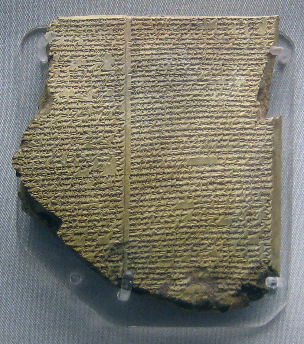
BackgroundThe Flood Tablet (Gilgamesh Tablet 11) in the British Museum. BabelStone, CC0 (public domain).
And the dove came in to him in the evening; and, lo, in her mouth was an olive leaf pluckt off: so Noah knew that the waters were abated from off the earth.
Genesis 8:11, KJV
The "Flood Tablet" is Tablet 11 of the Epic of Gilgamesh. It is a clay tablet from the library of the Assyrian king Ashurbanipal at Nineveh. It tells of a man, Utnapishtim, who is warned by a god, builds a boat, survives a great flood and lands on a mountain. He then sends out a dove, a swallow and a raven to see if the land is dry. George Smith of the British Museum recognized the story in 1872. Another Babylonian story, Atrahasis, is known from older copies. It tells of gods who send a flood because human noise disturbs them, and of a man who survives in a boat.
Where it is today
British Museum, London. Flood Tablet: K.3375, on display in Room 55. Atrahasis tablet: museum number 78943 (registration 1889,0426.236), on display in Room 56. A small later Atrahasis fragment is in the Metropolitan Museum of Art, New York (86.11.378a).
Date
Flood Tablet: 7th century BC (Ashurbanipal reigned 669 to about 631 BC). Atrahasis tablet 78943: about 1635 BC.
Why this label: These are real ancient tablets that show a great flood story was well known in Mesopotamia. They do not name Noah, and they do not prove or disprove Genesis.
Good to know: Scholars disagree on how these stories relate to Genesis.
Borrowing view: Samuel Noah Kramer (1967) held that the Old Testament account was based on the Mesopotamian story, and that both grew from a real but local flood about 3000 BC.
Shared memory view: James Battenfield (1971) held that all these accounts go back to a real worldwide flood, and that Genesis kept the true account without the many gods and myths of the tablets.
Keep in mind: The age of a tablet shows when that copy was written, not which account came first.
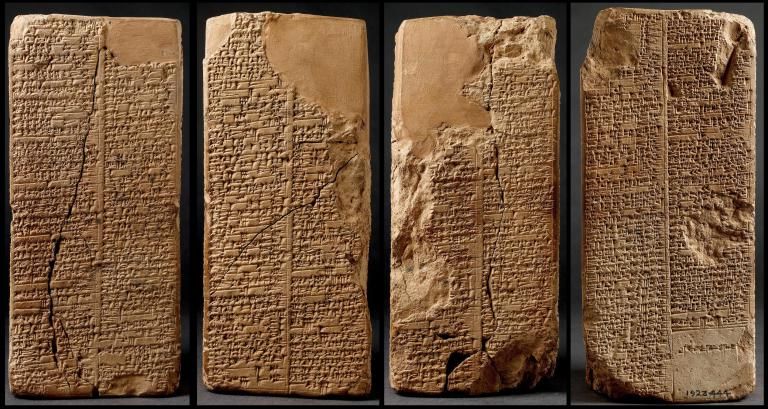
BackgroundThe four sides of the Weld-Blundell Prism, Ashmolean Museum, Oxford. Ashmolean Museum, Oxford, Public domain.
These are the families of the sons of Noah, after their generations, in their nations: and by these were the nations divided in the earth after the flood.
Genesis 10:32, KJV
This four-sided block of clay (called a prism), about 20 cm tall, holds the most complete copy of the Sumerian King List. The list names rulers, their cities and how long they reigned. It opens with kings who ruled before the flood, each given tens of thousands of years. Then it says, "Then the Flood swept over. After the Flood had swept over, and the kingship had descended from heaven, the kingship was in Kish." Like Genesis 5 to 10, it splits early history into before and after a great flood.
Where it is today
Ashmolean Museum, Oxford, England. Accession number AN1923.444.
Date
About 1800 BC. The list ends with King Sin-magir of Isin (about 1827 to 1817 BC). Probably from Larsa, Iraq. Given to the museum by Herbert Weld-Blundell in 1923.
Why this label: It shows that people in ancient Iraq remembered a great flood as a turning point in history. It does not name Noah or any person in Genesis.
Good to know: The Ashmolean calls the list "a combination of myth, legend and historical information". No record from their own time shows that any of the kings before the flood really lived. Their reigns (up to 43,200 years) are far longer than the lifespans in Genesis 5, where Adam lives 930 years. The Ashmolean also says the flood story was adapted in the Old Testament; that is one view, and the flood tablets entry gives the other side. The quoted lines come from the English translation in Ancient Near Eastern Texts, a standard collection, as shown on Livius.org. Not every copy of the list includes the section before the flood.
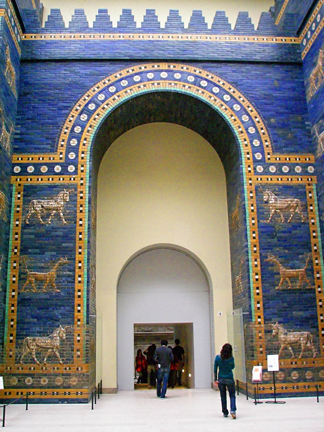
ConfirmedThe front part of the Ishtar Gate of Babylon, rebuilt in the Pergamon Museum, Berlin, from pieces found at Babylon together with new bricks. Hahaha (Wikimedia Commons), CC SA 1.0.
And the beginning of his kingdom was Babel, and Erech, and Accad, and Calneh, in the land of Shinar.
Genesis 10:10, KJV
Babel is the Hebrew name for Babylon. Genesis 10:10 names it as the first city of Nimrod's kingdom in the land of Shinar. Genesis 11 places the tower story in Shinar and says the city was called Babel. The ruins of Babylon stand beside the Euphrates in Iraq and have been a UNESCO World Heritage Site since 2019. It was the capital of kings such as Hammurabi and Nebuchadnezzar.
Where it is today
Iraq, about 85 km south of Baghdad, beside the Euphrates.
Date
First named in a record from about 2200 BC, when it was a small town. Capital of the Neo-Babylonian Empire from 626 to 539 BC. Many of the best-known ruins date from about 600 BC, long after the events of Genesis 10 and 11.
Why this label: The Hebrew Bible uses the one name, Babel, for this city throughout (English Bibles write it "Babylon" outside Genesis), and the site of Babylon is known and has been dug. This label covers the city, not the tower.
Good to know: Genesis 11:9 links the name Babel to the Hebrew word balal, which means to confuse; the two words sound alike. The Babylonians' own name, Bab-ilim, means "gate of the god". But many scholars now think that meaning was given later to an older name whose meaning is unknown.
Etemenanki, Babylon's temple tower, and the "Tower of Babel stele"
Genesis 11:3 · Genesis 11:4 · Genesis 11:9
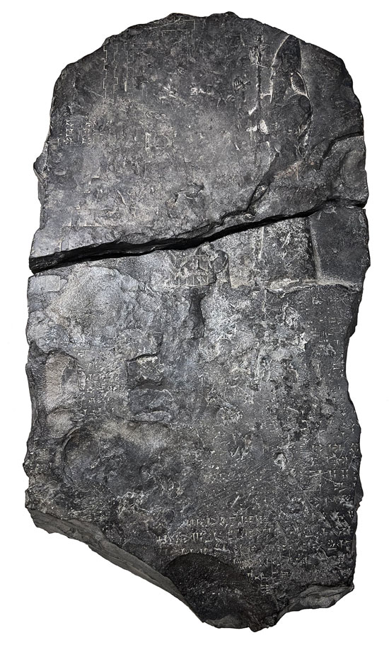
DisputedThe Tower of Babel stele, now in the Iraq Museum, Baghdad. Photo by Olof Pedersén, 2023, from his article in the journal Iraq, CC BY 4.0.
And they said, Go to, let us build us a city and a tower, whose top may reach unto heaven; and let us make us a name, lest we be scattered abroad upon the face of the whole earth.
Genesis 11:4, KJV
Etemenanki, "Temple of the Foundation of Heaven and Earth", was the great stepped temple tower (ziggurat) of the god Marduk in Babylon. It was rebuilt several times, including by Nabopolassar and his son Nebuchadnezzar the Second. A black stone slab (stele) shows Nebuchadnezzar the Second standing beside a side view of the tower, with a label naming it Etemenanki. Its inscription is partly broken. In the words that can be read or filled in, he says he called up people from many lands and built with bitumen (a natural tar) and baked brick. This recalls Genesis 11:3: "they had brick for stone, and slime had they for morter".
Where it is today
The tower's foundations remain at Babylon, Iraq. The stele (once Schoyen Collection MS 2063) was given back to Iraq in December 2023 and is held by the Iraq Museum, Baghdad.
Date
Stele: reign of Nebuchadnezzar the Second, 604 to 562 BC (about 600 BC). When the tower was first built is not known; Olof Pedersen thinks it was standing by about 1600 BC at the latest. The Assyrian king Sennacherib claimed to have destroyed it in 689 BC.
Why this label: The tower and the stele are real, and many scholars (and UNESCO's description of Babylon) link Etemenanki with the Tower of Babel story. But the stele was made long after the events of Genesis 11, and no inscription ties this tower to the tower in Genesis 11.
Good to know
Keep in mind: The stele does not prove the Tower of Babel; it shows the tower as it was rebuilt about 600 BC.
Later writing view: Some scholars use the link to argue that Genesis 11 was written during or after the Jewish exile in Babylon.
Older event view: Others hold that Genesis records a much older event, and that later kings kept rebuilding on old sites. The evidence does not settle it.
The stele itself: It spent 28 years in a private collection in Norway. Some scholars doubted it was genuine, partly because early reports of where it was found were wrong. In 2023 Uppsala scholar Olof Pedersen reported that local men found it in Babylon in the early 1990s, and said his study should answer those doubts. He also notes that the villagers' story is not backed by photos or witness statements.
ConfirmedThe Mashki Gate of Nineveh as rebuilt in modern times, seen from the west. Photo by Fredarch., CC BY-SA 3.0.
Out of that land went forth Asshur, and builded Nineveh, and the city Rehoboth, and Calah,
Genesis 10:11, KJV
Nineveh was a great Assyrian city on the east bank of the Tigris and the capital of the Assyrian Empire at its height. Genesis 10:11 first names it, and later it is the city Jonah was sent to and whose fall Nahum and Zephaniah foretold. Its ruins have two main mounds, Kuyunjik and Nabi Yunus ("Prophet Jonah"). Excavators found Sennacherib's palace and the library of Ashurbanipal, whose clay tablets are now mostly in the British Museum.
Where it is today
Across the Tigris from the old city of Mosul, northern Iraq. The ruins are enclosed by a city wall about 12 km around.
Date
Capital under Sennacherib (around 700 BC); destroyed in 612 BC by the Babylonians, Medes and Scythians.
Why this label: Digs since the 1840s have uncovered the palaces and library of the Assyrian kings who ruled from Nineveh, and scholars agree this is the Nineveh of the Bible.
Good to know: Islamic State fighters destroyed the shrine known as the tomb of Jonah in 2014 and damaged several of the city gates in 2015 and 2016. Some gates have since been repaired, and an archaeological park opened at the site in 2023. The KJV says Asshur went out and built Nineveh, while many modern versions read it as Nimrod's work (the NASB says "From that land he went forth into Assyria, and built Nineveh"). Either way it is the same city.
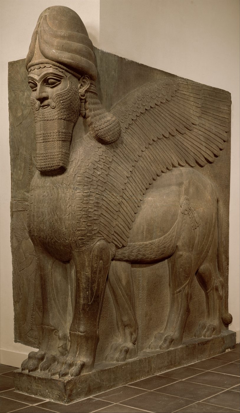
ConfirmedHuman-headed winged lion (lamassu) from Ashurnasirpal the Second's palace at Nimrud, about 883 to 859 BC. The Metropolitan Museum of Art, 32.143.2, Public Domain (Met Open Access).
And Resen between Nineveh and Calah: the same is a great city.
Genesis 10:12, KJV
Calah is the Assyrian city of Kalhu, known today as Nimrud. King Ashurnasirpal the Second made it his capital and built a large palace there. Austen Henry Layard began digging it in 1845 and sent two huge winged guardian statues to London. The Black Obelisk of Shalmaneser the Third, a black stone pillar carved with the king's wars, now in the British Museum, also came from here.
Where it is today
About 30 km south of Mosul, near the Tigris, northern Iraq. Finds are in the Iraq Museum, the British Museum, the Metropolitan Museum of Art and many other museums.
Date
Capital of Assyria from 879 to 706 BC.
Why this label: The city's Assyrian name, Kalhu, matches the Bible's Calah. Scholars debated the match in the 1800s but now broadly accept it.
Good to know: In 2015 and 2016 Islamic State fighters destroyed much of the site, including parts of the palace of Ashurnasirpal the Second and the temple tower. About 90 percent of the excavated area was lost. Repair work began in 2017. Many of the best carvings from Calah were taken to museums long before, so they can still be seen today, including in The Metropolitan Museum of Art and the British Museum.
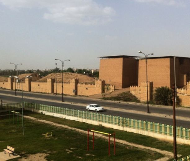
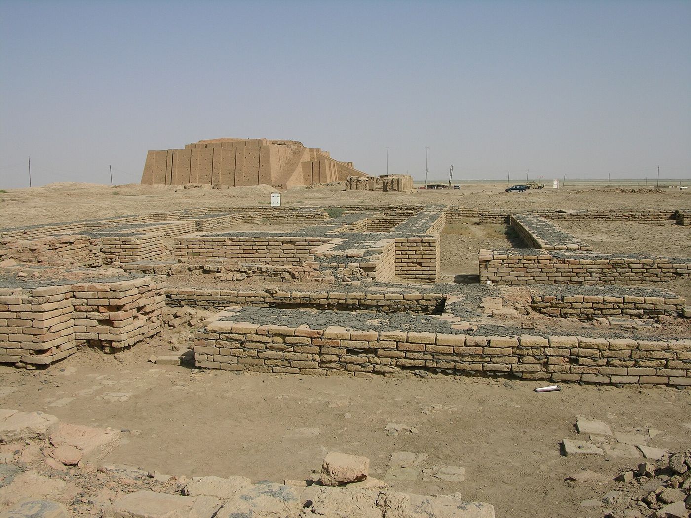
DisputedThe Ziggurat of Ur and nearby ruins, southern Iraq (2006). M. Lubinski, CC BY-SA 2.0.
And Terah took Abram his son, and Lot the son of Haran his son's son, and Sarai his daughter in law, his son Abram's wife; and they went forth with them from Ur of the Chaldees, to go into the land of Canaan; and they came unto Haran, and dwelt there.
Genesis 11:31, KJV
Genesis says Abram's family lived in Ur of the Chaldees before they moved to Haran. The best-known candidate is the ruined Sumerian city of Ur at Tell el-Muqayyar in southern Iraq (a tell is a mound built up from the layers of an old town). Its large stepped temple tower, the Ziggurat of Ur, was built about 2100 BC under King Ur-Nammu. Sir Leonard Woolley dug the site from 1922 to 1934 for the British Museum and the University of Pennsylvania and found about 1,850 burials, including 16 he called royal tombs.
Where it is today
Tell el-Muqayyar, Dhi Qar Governorate, southern Iraq, about 16 km southwest of Nasiriyah. Part of a UNESCO World Heritage Site since 2016. Most of the finds are in the British Museum (London), the Penn Museum (Philadelphia) and the Iraq Museum (Baghdad).
Date
Settled by about 3800 BC; a city-state (a city with its own king) by the 2500s BC; ziggurat built in the 21st century BC (about 2100 to 2000 BC); abandoned by the early 400s BC.
Why this label: Ur at Tell el-Muqayyar is a real, well-excavated city, and most scholars accept it as Abraham's Ur. But some serious scholars, such as Cyrus Gordon, have argued for a northern Ur near Haran, and nothing found at the site names Abraham.
Good to know
Southern Ur view: Supporters of the southern site point out that the Bible calls it Ur 'of the Chaldees', and the Chaldeans lived in southern Iraq. They do not think the long distance to Haran counts for much.
Northern Ur view: Supporters of a northern Ur say southern Ur is a long way from Haran, that the Ebla tablets name northern places called Ur, Ura and Urau, and that local tradition in Urfa (Sanliurfa, Turkey) says Abraham was born there.
The Chaldees question: The Chaldeans had settled near southern Ur by about 850 BC but did not rule Babylonia until the late 600s BC, long after Abraham's time. So both sides argue over what the name 'Chaldees' tells us.
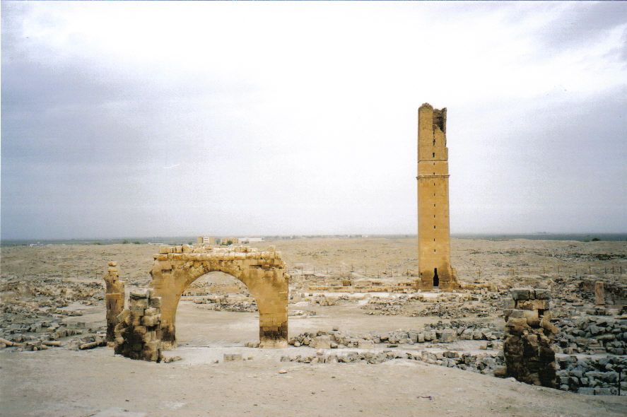
ConfirmedMedieval ruins at Harran, Turkey, with the tall square minaret (prayer tower) of the old Grand Mosque (2003). Gerry Lynch, CC BY-SA 3.0.
So Abram departed, as the LORD had spoken unto him; and Lot went with him: and Abram was seventy and five years old when he departed out of Haran.
Genesis 12:4, KJV
Genesis says Terah, Abram and their family settled in Haran, and Terah died there. Abram left Haran for Canaan when he was 75, and later Jacob fled to his uncle Laban in Haran. The ancient city of Harran in southeast Turkey still carries the same name. It was a major crossroads on the trade routes and a centre for worship of the moon god Sin. Clay tablets from Ebla (2300s BC) and Mari (about 1800 to 1760 BC) name the city.
Where it is today
Harran district, Sanliurfa Province, southeast Turkey, about 40 km southeast of Sanliurfa (Urfa) and near the Syrian border. Visitors can see the ancient mound, a castle, the ruins of an early mosque and a medieval university, and traditional beehive-shaped mud-brick houses.
Date
Named in written records from the 2300s BC; still a living town today. Most standing ruins (mosque, university, castle) are from many centuries after Abraham.
Why this label: The name Harran has stayed with the same place from ancient times until today, and ancient tablets confirm a city of that name at this crossroads. Scholars broadly agree it is the Haran of Genesis.
Good to know: Several names in Abram's family match place names near Haran in ancient texts. Mari and Assyrian records name a town called Nahur in this region, which matches the name Nahor, and some scholars link Terah to a place called Til-Turahi and Serug to Sarugi. These matches are background only: nothing found at Harran names Abram or Terah, and it is not certain whether 'the city of Nahor' in Genesis 24:10 was Haran itself or a nearby town.
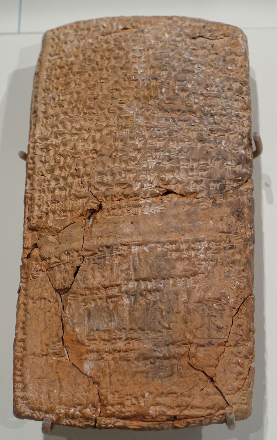
BackgroundClay tablet of Zimri-Lim, king of Mari, about building an ice-house at Terqa, about 1780 BC (Louvre AO 20161). Jastrow, Public domain.
And the servant took ten camels of the camels of his master, and departed; for all the goods of his master were in his hand: and he arose, and went to Mesopotamia, unto the city of Nahor.
Genesis 24:10, KJV
Mari was a large city on the Euphrates River. Its ruins form a tell (a mound built up from the layers of an old town) called Tell Hariri. French archaeologists from the Louvre, led by Andre Parrot, began digging there in 1933. They found more than 25,000 clay tablets, most of them from about 1800 to 1750 BC, the time of King Zimri-Lim. The letters and records show trade, treaties, religion and daily life in the region where Genesis places Abram's relatives. They name Haran and a town called Nahur, which matches the name Nahor, Abram's grandfather and brother.
Where it is today
Tell Hariri, near Abu Kamal, Deir ez-Zor Governorate, eastern Syria. Finds are in the Louvre (Paris), the National Museum of Aleppo, the National Museum of Damascus and the Deir ez-Zor Museum. The tablet in the photo is Louvre AO 20161.
Date
Archive mostly about 1800 to 1750 BC. Hammurabi of Babylon defeated Zimri-Lim about 1761 BC.
Why this label: The tablets show the names, places and customs of the world the patriarchs (Abraham, Isaac and Jacob) lived in. They do not mention Abraham or any other person from Genesis.
Good to know: Writers in the mid-1900s often claimed the Mari and Nuzi tablets proved the patriarch stories. From the 1970s, scholars such as Thomas Thompson and John Van Seters argued that much of this reasoning was weak. Even scholars who still see real parallels, such as Martin Selman, agreed that several of the older claims had to be dropped. A name like Nahur on a tablet shows the name was in use in that region; it does not show that it refers to the man in Genesis.
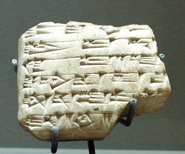
BackgroundNuzi clay tablet recording a court case over land, about 1450 to 1350 BC, in the museum of the Institute for the Study of Ancient Cultures (formerly the Oriental Institute), Chicago. Daderot, CC0 (public domain).
And Abram said, Behold, to me thou hast given no seed: and, lo, one born in my house is mine heir.
Genesis 15:3, KJV
Nuzi was a town near modern Kirkuk in northern Iraq. About 5,000 clay tablets from Nuzi are known. Most came from digs between 1925 and 1931, and most date from the 1400s and 1300s BC. Many are family and legal records. Some describe customs that look like ones in Genesis, such as a childless couple making a household member their heir (compare Eliezer in Genesis 15:2-3) and a wife giving a slave woman to her husband to bear children (compare Sarai and Hagar in Genesis 16).
Where it is today
Yorghan Tepe, southwest of Kirkuk, Iraq. The tablets are held mainly by the Institute for the Study of Ancient Cultures (formerly the Oriental Institute) at the University of Chicago, the Harvard Museum of the Ancient Near East (formerly the Harvard Semitic Museum) and the Iraq Museum in Baghdad.
Date
Mostly about 1450 to 1350 BC.
Why this label: The tablets show family law and customs in the region in the 1400s and 1300s BC. They do not name any person from Genesis, and many of the parallels once claimed have since been rejected.
Good to know: In the mid-1900s, scholars such as Cyrus Gordon and E. A. Speiser claimed Nuzi explained many Genesis stories. Later study rejected several of these claims, including the 'wife as sister' theory (that Abram calling Sarai his sister reflected a Nuzi custom) and the idea that Rachel took Laban's household gods to claim an inheritance. Some likenesses remain, but they are weaker than once thought. Genesis does not say Eliezer was adopted; that idea comes from the outside texts. The custom of a slave woman bearing children for a childless wife appears in only one Nuzi tablet and is known in Mesopotamia over more than 1,000 years, so it cannot date the patriarchs to one century. Scholar Wayne Pitard notes that most of these customs were still in use after 1000 BC, so they cannot show by themselves that the stories are early.
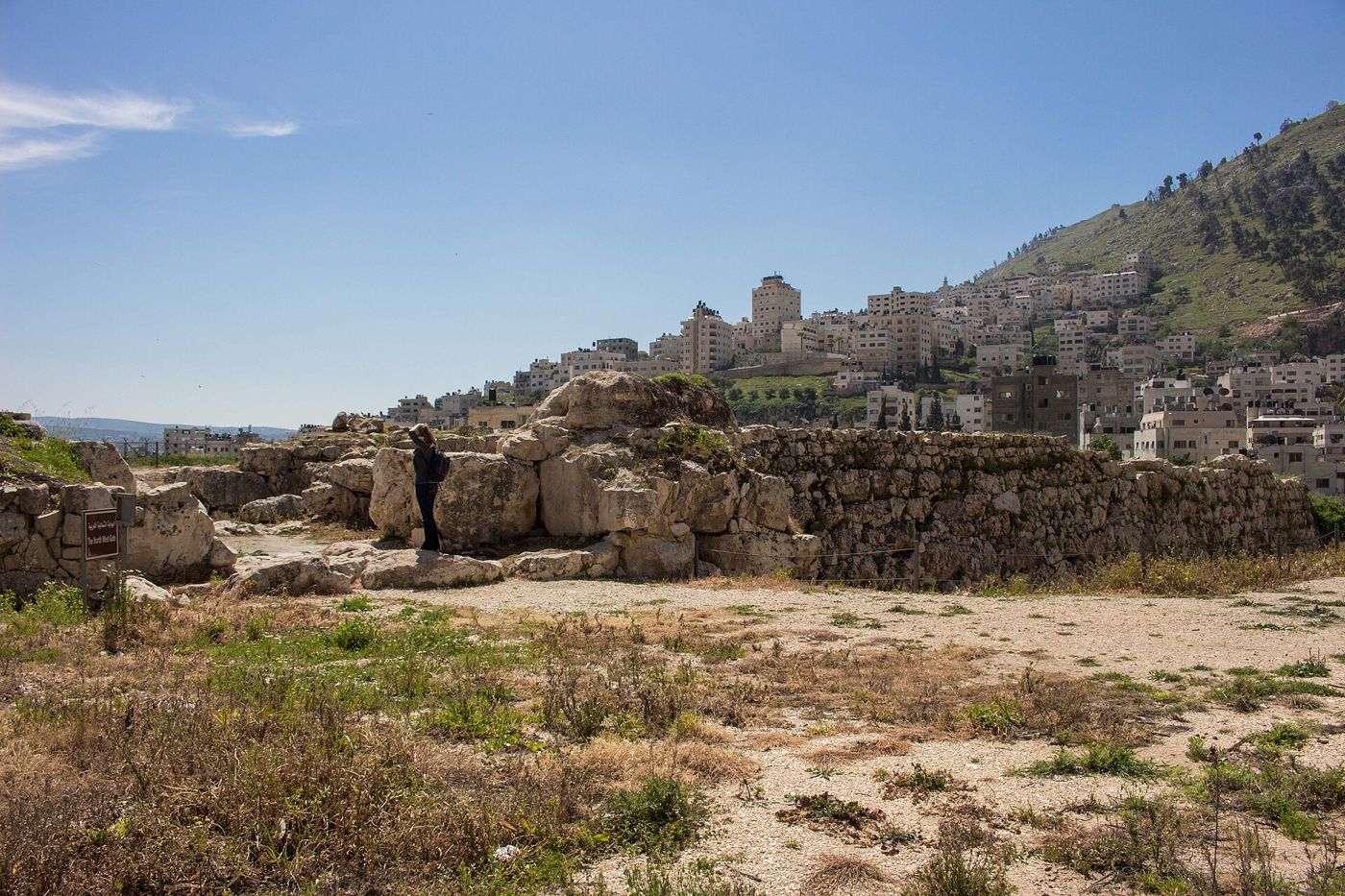
ConfirmedThe massive stone city wall beside the north-west gate at Tell Balata (ancient Shechem), with houses of Nablus behind. TrickyH, CC BY-SA 4.0.
And Abram passed through the land unto the place of Sichem, unto the plain of Moreh. And the Canaanite was then in the land.
Genesis 12:6, KJV
Shechem (spelled Sichem in Genesis 12:6 in the KJV) is the first place in Canaan where Genesis says Abram stopped and built an altar. Jacob later bought land there and built an altar too. The ruin mound of Tell Balata (a tell is a hill built up from the layers of an old town) lies in a mountain pass between Mount Gerizim and Mount Ebal and is identified as ancient Shechem. Digs there found massive city walls, two large gates (north-west and east), a palace and a large 'fortress' temple from about 1900 to 1150 BC. Egyptian texts from the 1800s BC and the Amarna letters (letters sent to the king of Egypt about 1350 BC) also mention Shechem.
Where it is today
Tell Balata Archaeological Park, Balata al-Balad, on the eastern edge of Nablus, West Bank. Check travel advice and access before planning a visit.
Date
First settled about 3500 to 3000 BC; main walled city about 1900 to 1150 BC; empty for a time, then lived in again from about 975 BC; rebuilt in the Greek period (late 300s BC) and finally destroyed in the late 100s BC.
Why this label: Scholars broadly agree that Tell Balata is Shechem, based on its location between Mount Gerizim and Mount Ebal and on ancient written descriptions. No inscription naming Shechem has been found at the site itself.
Good to know: Because there is no inscription on site, other places have been suggested. Archaeologist Yitzhak Magen, for example, places the later Samaritan city of Shechem, the one destroyed in the late 100s BC, on Mount Gerizim nearby; this is a minority view and concerns the later city. The 'plain of Moreh' (the NASB says 'the oak of Moreh') and Abram's altar have not been found. Nearby Jacob's Well and Joseph's Tomb are traditional sites, not proven ones.
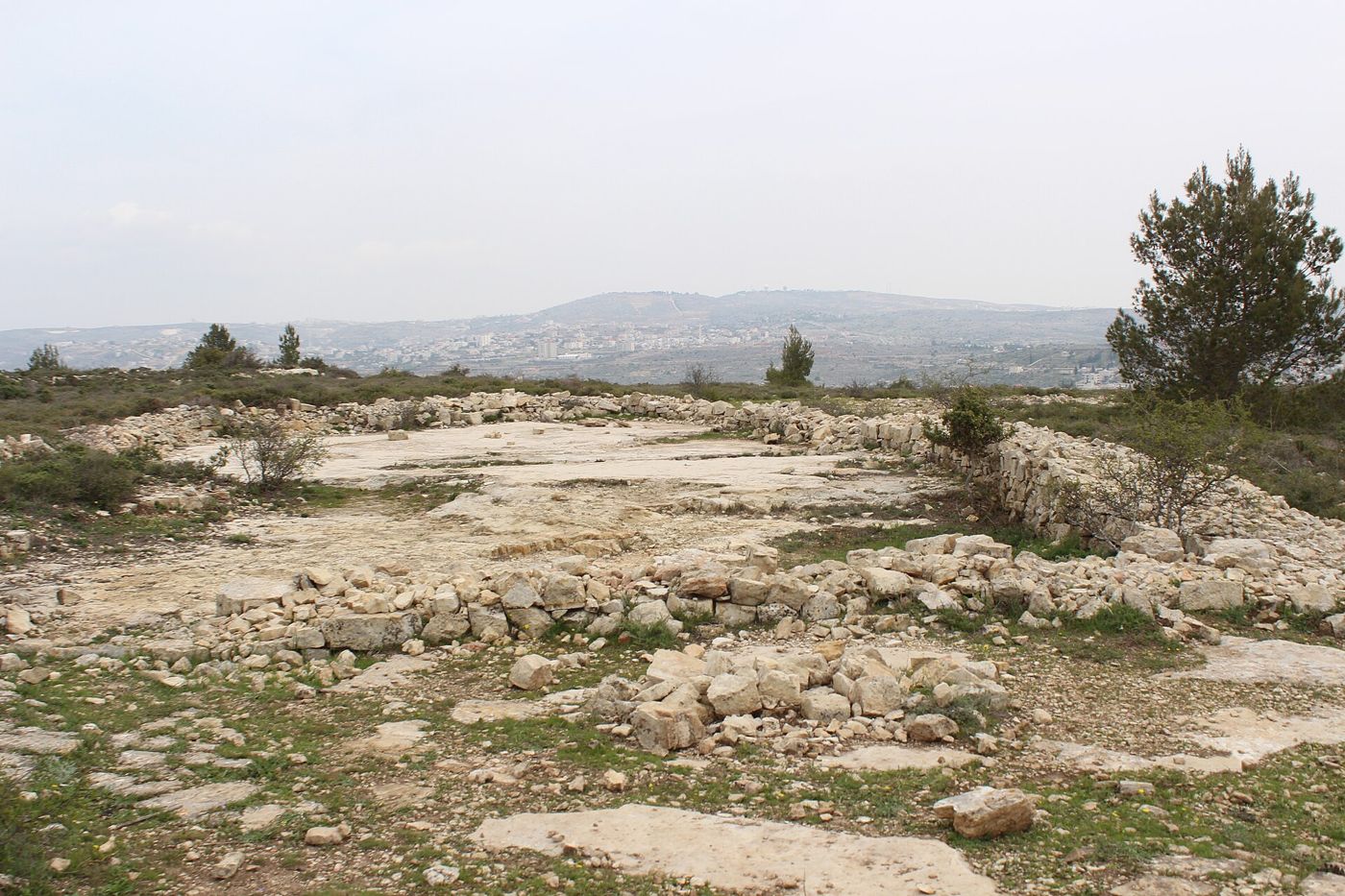
ConfirmedHilltop ruins near Beitin, labelled on Wikimedia Commons as Jeroboam's temple at Beth-el (1 Kings 12:29); what they were is not proven (2017). Deror_avi, CC BY-SA 4.0.
And he called the name of that place Beth-el: but the name of that city was called Luz at the first.
Genesis 28:19, KJV
Genesis says Abram pitched his tent and built an altar between Beth-el and Ai (Hai in the KJV). Later Jacob dreamed of a ladder reaching to heaven at this place and named it Beth-el, which means 'house of God'. Most scholars identify Beth-el with the Arab village of Beitin, whose name preserves the old name. William F. Albright and James L. Kelso excavated there in several seasons between 1927 and 1960.
Where it is today
Beitin, about 5 km northeast of Ramallah, West Bank. Remains include the Burj Beitin ruin, apparently built over an older Byzantine (eastern Roman) monastery and later used by the Crusaders as a watchtower, and the site of a church from the AD 400s.
Date
First settled more than 5,000 years ago. Pottery from the Bronze Age, the Iron Age (about 1200 to 600 BC), and the Persian, Greek, Roman, Byzantine and Crusader periods has been found. The site lay mostly empty after the Crusaders were defeated in 1187, until the modern village was founded in the mid-1800s. Excavated in 1927, 1934, 1937, 1954, 1957 and 1960.
Why this label: Most scholars identify Beitin with Beth-el, based on the surviving name and on ancient descriptions of where Beth-el lay. A small minority (David Livingston and John Bimson) has argued for nearby al-Bireh instead.
Good to know: The town can be located, but the exact spot of Jacob's dream cannot. Archaeologist Aharon Tavger has proposed a hill about 900 metres east of Beitin as Beth-el's ancient place of worship, and perhaps the place of Abram's altar (Genesis 12:8 puts the altar on a mountain east of Beth-el); this is not settled.
About the name: The old 'l' ending of Beth-el lasted until the Crusader period, while the 'n' ending of 'Beitin' is first recorded in the 1800s. Edward Robinson, one of the first to make the match in the 1800s, argued that a change from Hebrew 'el' to Arabic 'in' was not unusual.
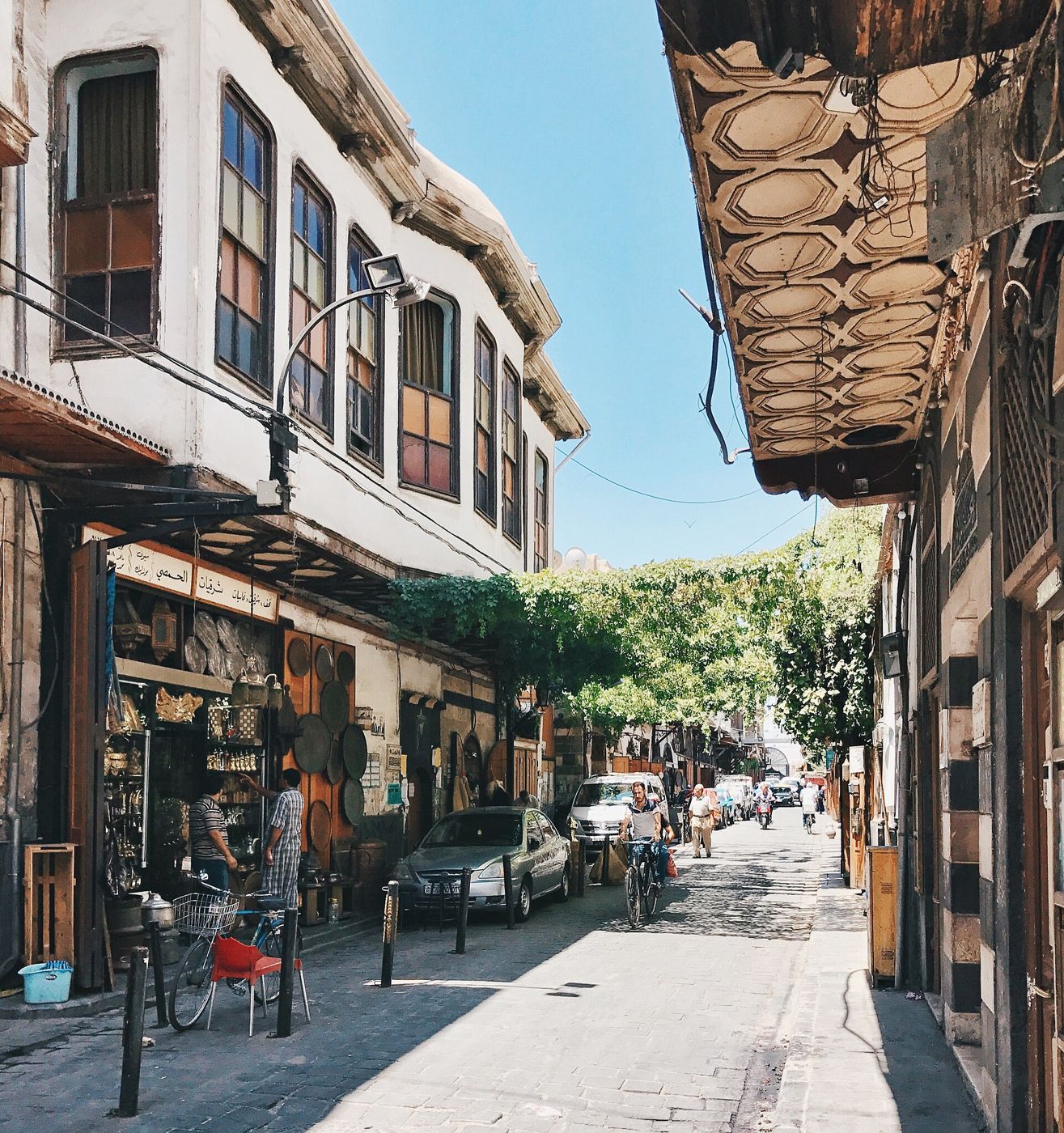
ConfirmedStraight Street in the Old City of Damascus. Bassel Khabbaz, CC BY-SA 4.0.
And Abram said, Lord GOD, what wilt thou give me, seeing I go childless, and the steward of my house is this Eliezer of Damascus?
Genesis 15:2, KJV
Genesis says Abram chased the kings who had captured Lot as far as Hobah, 'on the left hand of Damascus' (the NASB says 'north of Damascus'). It also says his chief servant Eliezer came from Damascus. Damascus is the capital of Syria today and still has the same name. Egyptian records from the 1400s and 1300s BC name it: a list of places conquered by Pharaoh Thutmose the Third, and the Amarna letters (letters sent to the king of Egypt about 1350 BC). Britannica notes an older tablet from Ebla that mentions 'Damaski', but treats the Egyptian records as the first certain mention. After about 1000 BC, Damascus became the capital of the Aramean kingdom of Aram (called Syria in the KJV), which is often named in the Bible.
Where it is today
Damascus, Syria. The walled Old City has been a UNESCO World Heritage Site since 1979. Straight Street, named in Acts 9:11, still runs through the Old City. Check travel advice before planning a visit.
Date
UNESCO says the city was founded in the 3rd millennium BC (between 3000 and 2000 BC). A town already stood nearby, at a mound called Tell al-Salihiyah, in the 4th millennium BC (between 4000 and 3000 BC). Still inhabited today.
Why this label: Damascus has kept its name and its place from ancient times until today, and it is named in Egyptian and other ancient records. There is no real doubt that it is the Damascus of Genesis.
Good to know: Damascus is often called 'the oldest continuously inhabited city in the world'. UNESCO says more carefully that it is 'among the oldest continually inhabited cities', and Britannica says it is unclear exactly when the oasis was first settled. Nothing found in Damascus names Abram or Eliezer.
Salem and Mount Moriah (the Temple Mount, Jerusalem)
Genesis 14:18 · Genesis 22:2 · 2 Chronicles 3:1
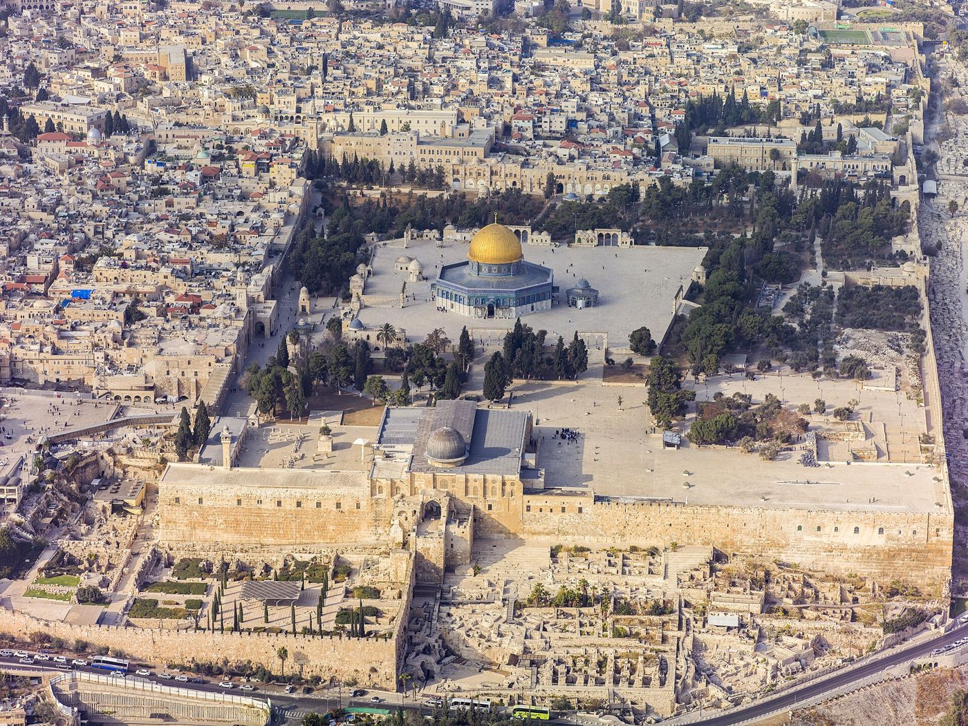
Traditional siteAerial view of the Temple Mount from the south, with Al-Aqsa Mosque in front and the Dome of the Rock behind (2013). Andrew Shiva / Wikipedia, CC BY-SA 4.0.
And he said, Take now thy son, thine only son Isaac, whom thou lovest, and get thee into the land of Moriah; and offer him there for a burnt offering upon one of the mountains which I will tell thee of.
Genesis 22:2, KJV
Genesis 14 says Melchizedek, king of Salem and priest of the most high God, brought Abram bread and wine. Psalm 76:2 names Salem alongside Zion, and Jewish and Christian tradition has long taken Salem to be Jerusalem. Genesis 22 says God sent Abraham to 'the land of Moriah' to offer Isaac on one of its mountains. The only other verse that uses the name Moriah, 2 Chronicles 3:1, says Solomon built the house of the LORD at Jerusalem in mount Moriah. That hill is the one now called the Temple Mount.
Where it is today
The Temple Mount in the Old City of Jerusalem, about 14.5 hectares (36 acres). The Dome of the Rock, built from about AD 685 and finished in 691 or 692 (sources differ), covers a rock outcrop that Jewish tradition links to the binding of Isaac (Genesis 22).
Date
Genesis events: no firm date. Solomon's temple: about 3,000 years ago (10th century BC by the Bible's own timeline). Dome of the Rock: about AD 685 to 692.
Why this label: Scripture itself links the name Moriah to the temple hill (2 Chronicles 3:1), and Psalm 76:2 links Salem with Zion. But no inscription or find can show the exact spot of Genesis 22, and Genesis speaks of 'the land of Moriah' and 'one of the mountains', not one named hill.
Good to know
Other places: Samaritans place the binding of Isaac on Mount Gerizim near Nablus, and many Muslims hold that the son was Ishmael and the place was near Mecca.
The name Moriah: Early translations treat the name differently in the two passages. For example, the Greek Old Testament says 'the high land' in Genesis 22, but keeps the name in 2 Chronicles 3:1.
Salem elsewhere: Some scholars, such as Robert Cargill, argue that Salem was a separate town near Shechem, not Jerusalem, pointing to Genesis 33:18, where the KJV reads 'Shalem, a city of Shechem'. Against this, many modern versions read that verse with no town called Shalem (the NASB says 'Jacob came safely to the city of Shechem').
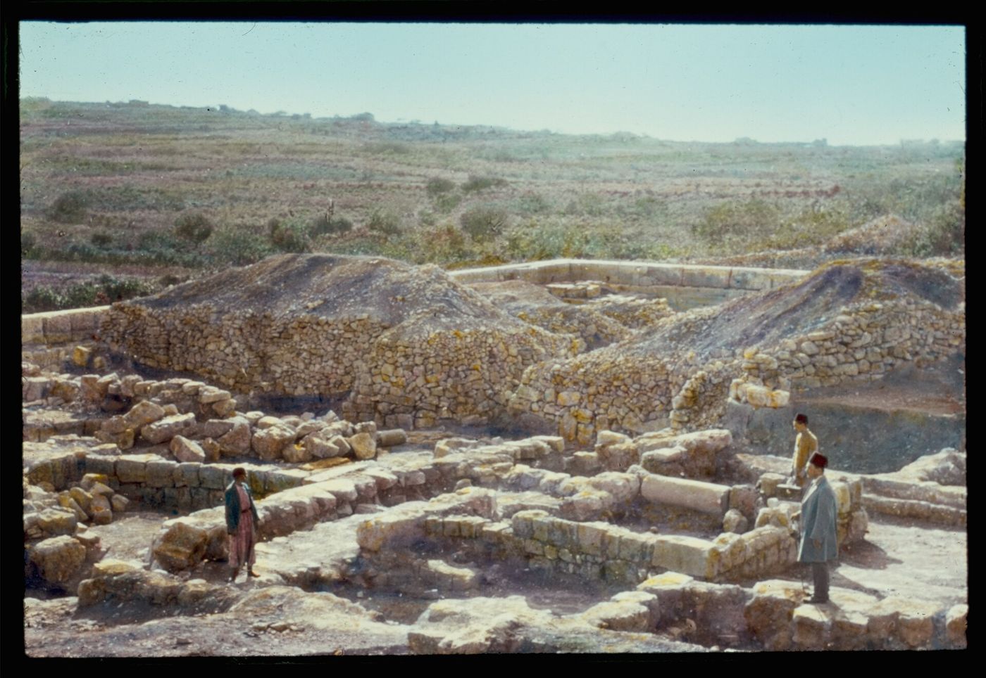
Traditional siteDigging at Ramat el-Khalil (Mamre), probably during the German digs of 1926 to 1928, in a colour-tinted photo. Matson Collection, Library of Congress, Public domain.
And the LORD appeared unto him in the plains of Mamre: and he sat in the tent door in the heat of the day;
Genesis 18:1, KJV
Genesis says Abraham camped by Mamre near Hebron, built an altar there, and met the LORD and three visitors at his tent. Ramat el-Khalil, about 3 to 4 km north of old Hebron, is the place that early Christian writers called Mamre from the AD 320s onward. It has a large stone enclosure, about 62 to 65 metres long and 45 to 49 metres wide, with walls about 2 metres thick. Parts of it date to the time of King Herod (late 1st century BC) and parts to the Roman emperor Hadrian (2nd century AD). Around AD 325 the emperor Constantine ordered pagan worship at the sacred tree there to stop and had a church built inside the enclosure. A Christian traveller from Bordeaux, France, saw the finished church in AD 333.
Where it is today
Ramat el-Khalil (also called Haram Ramet el-Khalil), on the north side of Hebron, West Bank. A French and Palestinian team led by the University of Poitiers has been digging there in recent years (its 6th season was in 2023). A separate 'Oak of Abraham' is shown at the Russian Orthodox Holy Trinity monastery in Hebron.
Date
Enclosure: late 1st century BC (Herod), rebuilt in the 2nd century AD (Hadrian). Church: about AD 325 to 333. Some pottery from about 2600 to 2000 BC has been found, but there is no sign that anyone lived there from about 2000 to 600 BC.
Why this label: Herod built a large enclosure here, and Christian writers named the place Mamre from the AD 320s. No inscription or find ties the spot to Abraham, and the Bible does not give its exact location.
Good to know
Tree or plain: The KJV says 'plains of Mamre', while many other translations, including the NASB, say 'oaks' or 'terebinths' (a kind of tree) of Mamre. This is why a sacred tree became part of the tradition.
Other sites: The Jewish historian Josephus (about AD 75) says a very large, very old tree was shown 6 furlongs (about 1 km) from Hebron. Ramat el-Khalil is farther away than that, so it is not certain that he meant this spot. Some scholars think an earlier Mamre was at Khirbet Nimra, a little to the south, and that Herod moved the tradition to Ramat el-Khalil, but digging at Khirbet Nimra has not proven this. The 'Oak of Abraham' at the Russian monastery is a separate tradition that goes back only to the 1800s, and that tree fell in 2019.
The digs: Diggers found no remains from the time usually given for Abraham. But people who live in tents and move with their herds leave few traces.
The Cave of Machpelah (Cave of the Patriarchs), Hebron
Genesis 23:19 · Genesis 25:9 · Genesis 49:29-32
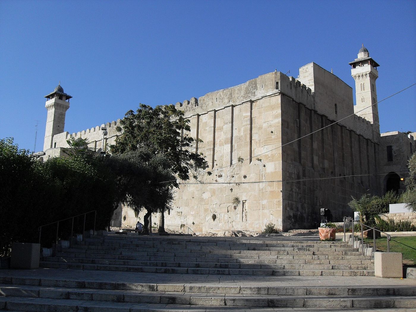
Traditional siteHerod's stone enclosure over the Cave of Machpelah in Hebron. The two towers on top were added in the Middle Ages. Djampa, CC BY-SA 4.0.
And after this, Abraham buried Sarah his wife in the cave of the field of Machpelah before Mamre: the same is Hebron in the land of Canaan.
Genesis 23:19, KJV
Genesis says Abraham bought the cave of Machpelah at Hebron to bury Sarah, and that Abraham, Isaac, Rebekah, Jacob and Leah were later buried there too (Genesis 25:9; 49:29-32; 50:13). Over the traditional cave stands a huge stone enclosure built by Herod the Great in the late 1st century BC, with walls about 1.8 metres thick. It is the only building from Herod's time that still stands complete. Inside are memorial markers (cenotaphs) for the three patriarchs and their three wives, and one for Joseph, all made in the Middle Ages. These markers are monuments, not the graves themselves. The graves are said to lie in caves below the floor.
Where it is today
Old City of Hebron, West Bank. The building is used today as both a mosque (the Ibrahimi Mosque) and a synagogue. Access is limited, so check before planning a visit.
Date
Building: late 1st century BC (Herod the Great, ruled 37 to 4 BC). Pottery found in a cave under the building in 1981 was dated in a 2020 study to the late 800s and the 700s BC.
Why this label: The Jewish historian Josephus, writing about AD 75, says the tombs of Abraham's family were shown at Hebron, and Herod's builders had already put this monument over the cave. So the burial tradition was firmly held by then. No digging or inscription has confirmed who is buried in the caves below.
Good to know: The digs: The caves under the floor have never been properly dug, and the Muslim authorities have long kept people out of them out of respect for the dead. A monk reported finding bones there in 1119, when Crusaders ruled the area. In 1968 a young girl was lowered through a narrow shaft and took photographs below. In 1981 a small group entered a cave and found four clay pots from the late 800s and the 700s BC. The authors of a 2020 study of these pots think people may already have been visiting the site as a holy place then. None of this shows who is buried there.
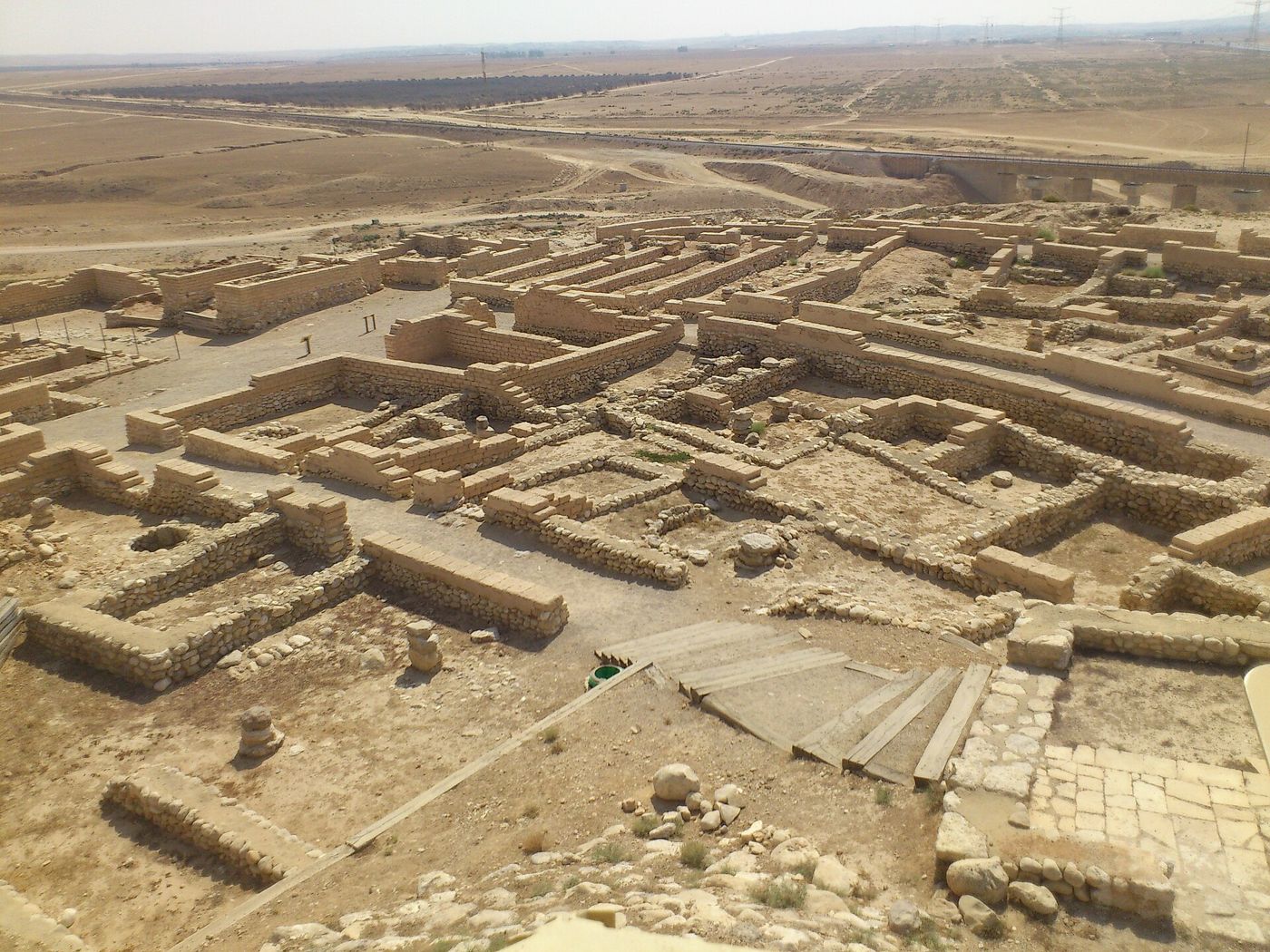
ConfirmedThe ruins of the walled town at Tel Be'er Sheva, seen from above. Moshe David, CC BY 2.5.
Wherefore he called that place Beer-sheba; because there they sware both of them.
Genesis 21:31, KJV
Genesis says Abraham made a sworn agreement with Abimelech over a well at Beer-sheba and 'planted a grove' there (the Hebrew word means a tamarisk, a kind of desert tree). Later, Isaac's servants dug a well there too. Tel Be'er Sheva is a mound about 4 km east of the modern city of Beersheba. A 'tel' is a hill built up from the ruins of towns built one on top of another. Scholars widely accept it as the site of biblical Beer-sheba. Digs from 1969 to 1976 uncovered a small, carefully planned, walled Israelite town. Just outside the town wall is a very deep well; diggers reached water about 69 metres down.
Where it is today
Tel Be'er Sheva National Park, near Beersheba, southern Israel. Part of the UNESCO World Heritage Site 'Biblical Tels: Megiddo, Hazor, Beer Sheba' (2005).
Date
First small settlement in the 1200s or 1100s BC (studies differ). Walled town from about the 10th century BC until it burned in the late 8th century BC, possibly in the Assyrian attack of 701 BC. The deep well was cut at about the time the site first became a lasting settlement.
Why this label: Scholars broadly agree that Tel Be'er Sheva is the biblical town of Beer-sheba known from the time of the judges and kings. The case does not rest on an inscription. It rests on two facts: this is the only walled mound near Roman and modern Beersheba, and its Arabic name, Tell es-Seba, keeps part of the old name. This label covers the place only: nothing found at the mound dates to the time of Abraham or Isaac, and the deep well is not proven to be either of their wells.
Good to know
The digs: The town that was dug up dates from centuries after the time usually given for the patriarchs. Diggers went down to bedrock over much of the mound. Apart from a few pieces of pottery from before 3000 BC, the earliest settlement they found began about 1200 BC.
Two readings: The digger Ze'ev Herzog thought the stories of the patriarchs at Beer-sheba came from the time of that first small village, and he called it 'tempting' to see the deep well as the well of Abraham's oath. Others note that Genesis describes wells, a planted grove and tent camps, which would leave little to find, and that the patriarchs' wells may have been elsewhere in the Beer-sheba valley. Some take the lack of early remains as a sign that the stories come from a later time.
The city well: The 'Abraham's Well' shown in the modern city dates to at least the 12th century AD.
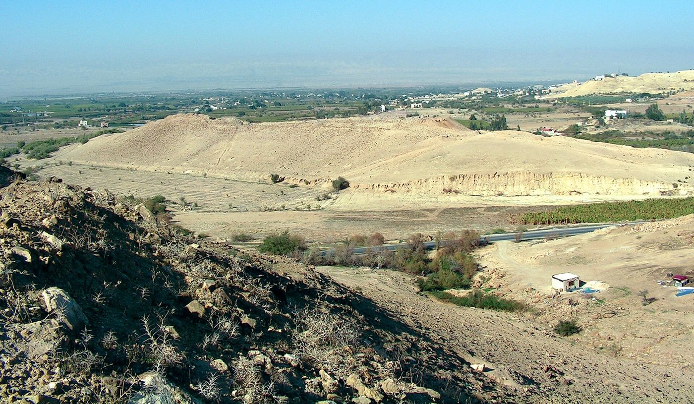
DisputedThe mound of Tall el-Hammam in the Jordan Valley, seen from the nearby hills, 2007. Deg777, CC BY-SA 4.0.
Then the LORD rained upon Sodom and upon Gomorrah brimstone and fire from the LORD out of heaven;
Genesis 19:24, KJV
Genesis places Sodom and Gomorrah among the 'cities of the plain' near the Jordan and says God destroyed them with fire and brimstone. There are two main proposals. The northern view puts Sodom at Tall el-Hammam in Jordan, a large ancient city north-east of the Dead Sea. Steven Collins of Trinity Southwest University has led digs there since 2005. Others think Tall el-Hammam was Abel-shittim, a place named in Numbers 33:49. The southern view looks to towns near the south-east shore of the Dead Sea in Jordan that flourished about 3000 to 2350 BC, such as Bab edh-Dhra and Numeira, dug by Walter Rast and Thomas Schaub. Some also think the cities lie under the shallow southern end of the Dead Sea.
Where it is today
Tall el-Hammam: Jordan Valley, Jordan, about 12 km north-east of the Dead Sea. Bab edh-Dhra and Numeira: south-east of the Dead Sea, Karak region, Jordan. Mount Sodom: south-west shore of the Dead Sea, Israel.
Date
Tall el-Hammam: at its largest about 2000 to 1550 BC; the retracted paper described below dated its destruction to about 1650 BC. Bab edh-Dhra: a town from about 3000 to 2350 BC. Numeira: destroyed by fire about 2600 BC. One scholar, Kris Udd, has argued that both towns ended later, about 2100 to 1950 BC.
Why this label: No inscription names any of these sites, and informed scholars, including Bible-believing archaeologists, disagree sharply about which site, if any, is Sodom. Each candidate has problems with either its location or its date.
Good to know
Northern view: Supporters point to Genesis 13:10-11, where Lot looks out from near Beth-el over 'all the plain of Jordan'. An end about 1650 BC is about 200 years later than either Bible-based reckoning in this page's dating notes allows for Abraham, though it falls in the looser range of about 2000 to 1550 BC that many scholars use.
Southern view: Supporters point to Genesis 14:3, which says the kings of Sodom and Gomorrah gathered in 'the vale of Siddim, which is the salt sea', and say the towns by the south-east shore fit the Bible's description of the area. But on the usual dates Bab edh-Dhra ended about 2350 BC, earlier than either Bible-based reckoning. Udd's later dates would bring the two much closer.
The airburst paper: In September 2021 the journal Scientific Reports published a paper claiming that a blast from an exploding space rock (an 'airburst') destroyed Tall el-Hammam, and suggesting this event could be the source of the Sodom story. Critics found that some images had been altered and that the evidence did not support the claim. The authors issued corrections (February 2022 and May 2023), the editors added a note of concern (February 2023), and the journal withdrew (retracted) the paper on 24 April 2025, saying the data did not support its conclusions. Eleven of the 21 authors disagreed with the retraction, and one of them, Allen West, said they would publish again with new data.
Salt pillar: A salt pillar on Mount Sodom in Israel is nicknamed 'Lot's Wife', but it is a natural formation on a mountain made mostly of salt. The name is folklore only.
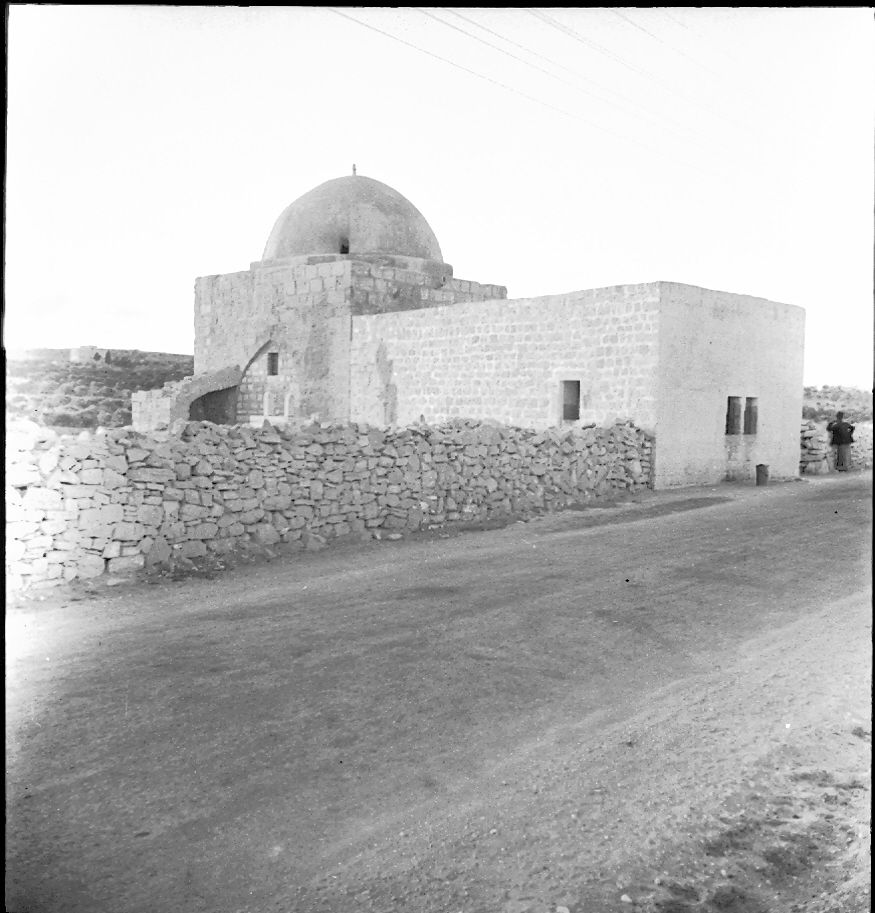
Traditional siteRachel's Tomb beside the road near Bethlehem, in an old black-and-white photo taken before the modern walls were built around it. Jehonatan Leurer, PikiWiki Israel, Public domain.
And Rachel died, and was buried in the way to Ephrath, which is Beth-lehem.
Genesis 35:19, KJV
Genesis says Rachel died giving birth to Benjamin on the road to Ephrath (Beth-lehem) and that Jacob set up a pillar on her grave (Genesis 35:16-20; 48:7). The small domed shrine at the north entrance of the modern town of Bethlehem has been shown as her tomb since at least the early 4th century AD. The first known writers outside the Bible to describe it are the church historian Eusebius (before AD 324) and a Christian traveller from Bordeaux, France (AD 333). Jews, Christians and Muslims have all honoured it.
Where it is today
North entrance of Bethlehem, West Bank. Access is limited, so check before planning a visit.
Date
Present building mainly from the Ottoman Turkish period, repaired and enlarged by Moses Montefiore in 1841 and 1845. The tradition of the site is recorded from the early AD 300s.
Why this label: The site has been honoured as Rachel's grave for about 1,700 years, but no inscription or excavation confirms it. Bible verses can be read in more than one way about where the grave was, so the exact spot is debated.
Good to know
The digs: When the building was repaired in about 1825, digging at its base showed that it does not stand over a burial cave, though a deep cave was found a short distance away.
Northern view: 1 Samuel 10:2 places Rachel's tomb 'in the border of Benjamin at Zelzah', and Jeremiah 31:15 (quoted in Matthew 2:18) links Rachel's weeping with Ramah. Benjamin's land and Ramah are both north of Jerusalem. So some scholars place the grave north of Jerusalem and think the words 'which is Beth-lehem' were added later.
Southern view: Others answer that the Hebrew word for 'border' can mean the edge of Benjamin's land, whose southern border ran just south of Jerusalem. They note that Genesis says Rachel died 'in the way' to Ephrath and not in the town itself, and that Jeremiah's words are about mourning, not about where the grave is. Matthew 2:16-18 also applies those words to the children killed at Bethlehem. Even some who accept a grave south of Jerusalem think the present shrine is too far south to match 1 Samuel 10:2.
Traditional siteThe Greek Orthodox church built over Jacob's Well, Nablus. The well is in the crypt below. Tiamat, CC BY-SA 3.0.
Now Jacob's well was there. Jesus therefore, being wearied with his journey, sat thus on the well: and it was about the sixth hour.
John 4:6, KJV
Genesis says Jacob camped near Shechem and bought a piece of land there (Genesis 33:18-19), and Joshua 24:32 says Joseph's bones were later buried in that plot. John 4 says Jesus sat by 'Jacob's well' near this land and spoke with a Samaritan woman. The well shown today lies close to Tell Balata, the mound (tel) accepted as the ruins of ancient Shechem, at the foot of Mount Gerizim. This fits the woman's words about 'this mountain' (John 4:20). The well is deep, as John 4:11 says: in 1935 it measured about 41 metres.
Where it is today
Balata, on the east side of Nablus, West Bank, in the crypt of the Greek Orthodox church and monastery of Bir Ya'qub.
Date
The well itself is undated. Christian pilgrims linked it to John 4 by the AD 330s; a cross-shaped church stood over it by about AD 384; a Crusader church was built in 1175; the present church is a modern rebuilding on the Crusader plan.
Why this label: Christian tradition has pointed to this well since the AD 330s, about 1,700 years, and Samaritans also link it to Jacob. Its depth and its place near Shechem and Mount Gerizim match John 4 closely. No inscription names it, and the Old Testament never says Jacob dug a well, so the link to Jacob rests on John 4 and tradition.
Good to know: This is one of the better-supported traditional sites, because a deep, old well near Shechem and Mount Gerizim matches the details of John 4. No find dates the well itself; the remains around it belong to the churches built over it. Where Sychar (John 4:5) was is still debated. The nearby village of Askar has been suggested, but some doubt this because Askar has its own spring. Others think Sychar is another name for Shechem.
Beni Hasan tomb painting of Asiatic visitors (tomb of Khnumhotep the Second)
Genesis 37:25 · Genesis 42:5 · Genesis 46:6
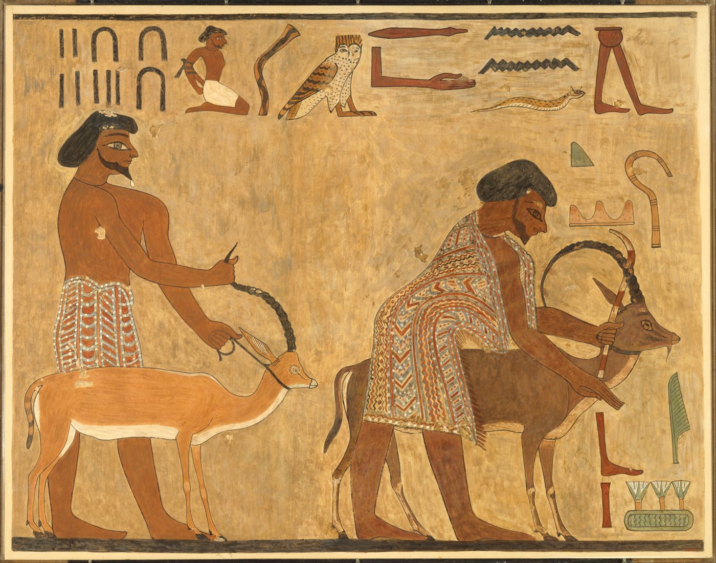
BackgroundFull-size 1931 painted copy of two leaders of the group from the Beni Hasan tomb wall. The bowing man on the right, holding an antelope, is their leader Abisha; the man on the left leads a gazelle. The Metropolitan Museum of Art, 33.8.17 (copy by Norman de Garis Davies, 1931), Public Domain (Met Open Access).
And they took their cattle, and their goods, which they had gotten in the land of Canaan, and came into Egypt, Jacob, and all his seed with him:
Genesis 46:6, KJV
A wall painting in the tomb of an Egyptian governor named Khnumhotep the Second shows a group of people from western Asia arriving in Egypt. The Egyptians called such people Aamu, often translated 'Asiatics'. The leader is named Abisha (also spelled Absha or Ibsha) and is called a 'ruler of a foreign land'. Fifteen people are shown: eight men, four women and three children, with donkeys. The men have beards and wear brightly patterned robes or kilts, and most of them wear sandals. They carry bows, spears and other weapons, a lyre (a small harp) and a water skin. The caption says they brought eye paint to Egypt. The painting helps us picture what a family group from Canaan or nearby lands looked like when it travelled down to Egypt, as Jacob's sons did in Genesis 42 to 46.
Where it is today
Tomb 3 (BH 3), north wall, at Beni Hasan in Minya Governorate, Middle Egypt. A full-size 1931 painted copy of part of the scene, made by Norman de Garis Davies, belongs to The Metropolitan Museum of Art, New York (object 33.8.17, 'Leaders of the Aamu of Shu'). The copy is not on display at present.
Date
About 1890 to 1880 BC. The caption dates the visit to year 6 of King Senusret the Second (12th Dynasty); experts' dates for his reign differ by a few years.
Why this label: The painting is real and well dated, and it shows the kind of people, clothing and travel the Bible describes. It does not name or show Joseph, Jacob or any Israelite.
Good to know: This is not Jacob's family. The leader's name is Abisha, the caption counts 37 people, and it says they brought eye paint, while Genesis says Jacob's household came because of famine. Scholars who use this painting to show what the patriarchs' world looked like say plainly that no one claims these people are Israelites.
Avaris (Tell el-Dab'a) and the claims of a 'Joseph palace'
Genesis 45:10 · Genesis 47:11 · Genesis 47:27
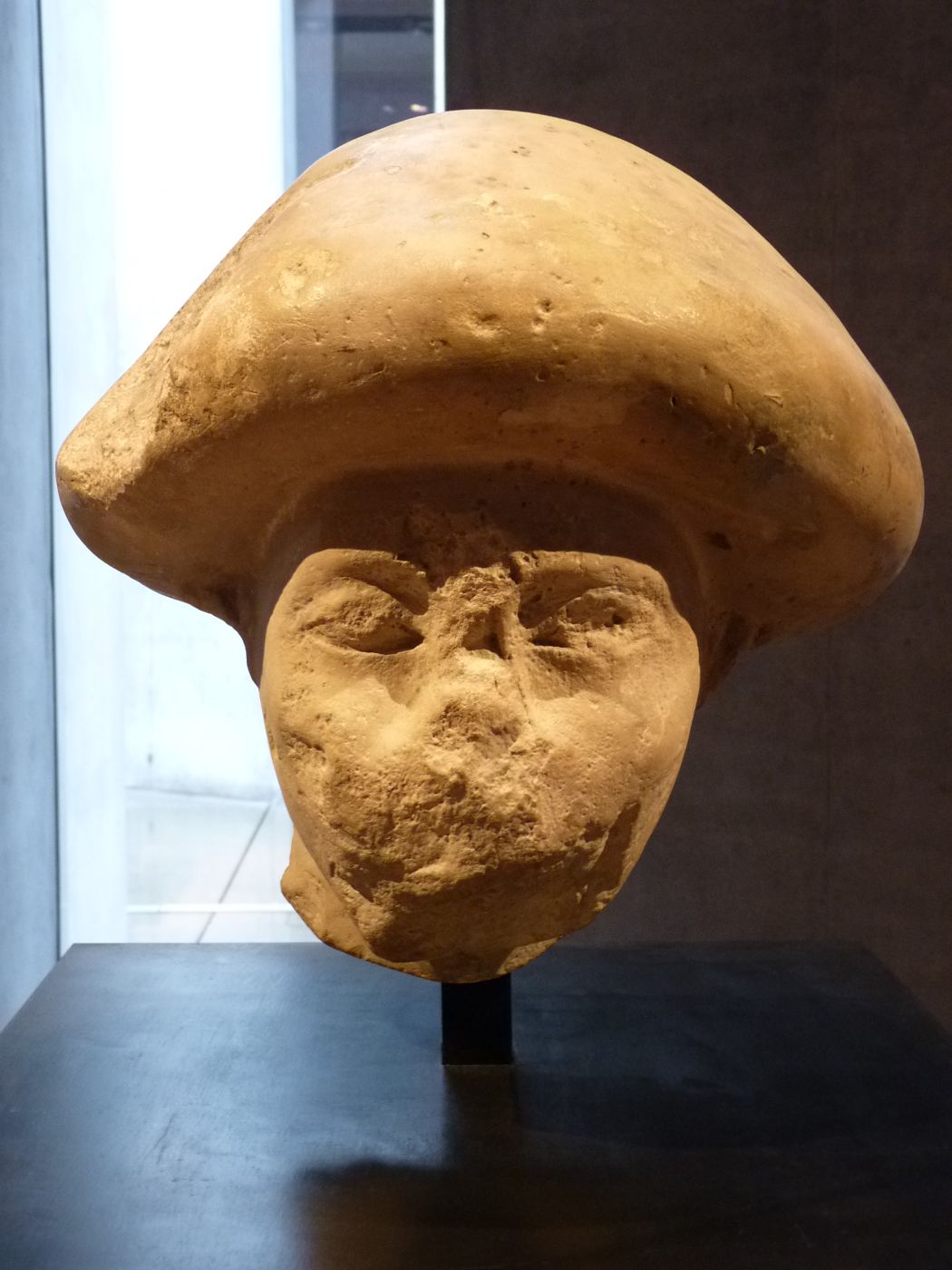
DisputedLimestone head of an Asiatic official with a mushroom-shaped hairstyle, in the State Museum of Egyptian Art, Munich (ÄS 7171). It is not the statue found at Avaris; the Avaris diggers call it the closest match to their statue. Khruner, CC BY-SA 3.0.
And Joseph placed his father and his brethren, and gave them a possession in the land of Egypt, in the best of the land, in the land of Rameses, as Pharaoh had commanded.
Genesis 47:11, KJV
Tell el-Dab'a is the ruin of Avaris, a city in the eastern Nile Delta, the general area where the Bible places Goshen and 'the land of Rameses'. Austrian teams led by Manfred Bietak (1966 to 2009) and then Irene Forstner-Müller found that many people from Canaan and Syria lived there from the late 12th Dynasty (about 1820 BC) onward. A large Syrian-style house, their weapons, and the donkeys they buried at the entrances of tombs show that they kept many of their own customs, though most of their pottery was Egyptian. Avaris later became the capital of the Hyksos, foreign kings who ruled northern Egypt. The later city of Pi-Ramesses, built by Ramesses the Second, spread over the same area.
Where it is today
Tell el-Dab'a, near Qantir, Sharqia Governorate, north-eastern Nile Delta, Egypt.
Date
Settlement of people from Canaan and Syria from about 1820 BC; Hyksos capital about 1640 to 1530 BC; Pi-Ramesses built in the 1200s BC.
Why this label: The site and its large population from western Asia are real and well studied. The claims that a house, tomb or statue found there belonged to Joseph (or to Jacob) rest on interpretation only, with no inscription naming either man, and most archaeologists do not accept them.
Good to know
Joseph claims: David Rohl, in the 2014 film 'Patterns of Evidence: The Exodus', linked a broken, larger-than-life statue of a seated Asiatic official with Joseph and his 'coat of many colours'. The statue had a striped cloak, red mushroom-shaped hair and a throw stick. Some conservative writers have also suggested that a large palace-like house nearby was Joseph's home. Rohl's version depends on his own revised dating of Egyptian history, which most Egyptologists do not accept.
Jacob claim: Douglas Petrovich keeps the standard Egyptian dates and still argues that Jacob's family lived at Avaris; he thinks the statue shows Jacob, not Joseph.
Mainstream view: The diggers describe these people as Asiatics, that is, people from Canaan and Syria, and nothing found at Avaris names Israel, Joseph or Jacob. People from western Asia in similar dress also appear at Beni Hasan, so the clothing does not point to one person.
The name Rameses: The city of Rameses was built in the 1200s BC, so Genesis 47:11 is often read as using the later name for the area.
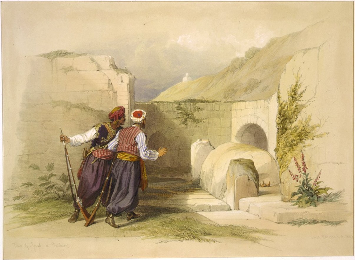
Traditional siteJoseph's Tomb at Shechem as drawn by David Roberts in 1839, before the building was rebuilt in 1868. David Roberts and Louis Haghe, Library of Congress, Public domain.
And the bones of Joseph, which the children of Israel brought up out of Egypt, buried they in Shechem, in a parcel of ground which Jacob bought of the sons of Hamor the father of Shechem for an hundred pieces of silver: and it became the inheritance of the children of Joseph.
Joshua 24:32, KJV
Joseph asked that his bones be carried out of Egypt (Genesis 50:25; Hebrews 11:22). Moses took them (Exodus 13:19), and Joshua 24:32 says they were buried at Shechem, on the land Jacob bought (Genesis 33:19). The Bible does not say where in Shechem the grave was. A small shrine with a stone grave marker at Balata, on the edge of Nablus, has been honoured as Joseph's tomb for many centuries by Samaritans, Jews, Christians and Muslims. It lies about 300 metres from Jacob's Well and close to Tell Balata, the ruin of biblical Shechem.
Where it is today
Balata village, eastern edge of Nablus, West Bank, at the opening of the valley between Mount Gerizim and Mount Ebal. Access is limited, so check before planning a visit.
Date
A tomb of Joseph at Shechem is first recorded outside the Bible in the early AD 300s, by the church historian Eusebius and by a Christian traveller from Bordeaux, France (AD 333). The present building comes from a full rebuilding finished in 1868 and has no older parts.
Why this label: Shechem is a firmly identified place, so the Bible's general location is clear. But no inscription or dig shows that this shrine holds Joseph's burial, and the present building is only about 150 years old.
Good to know
Same spot: Writers over the centuries did not always point to the same place, and some medieval reports seem to describe other spots near Nablus. So it is not certain that the oldest reports describe the present shrine.
Other traditions: Some placed Joseph's burial at Hebron (in the Cave of the Patriarchs) or at Safed, and later Muslim writers also named a site near the village of Beit Ijza. Some regard the shrine as the grave of Yusuf Dawiqat, a Muslim holy man of the 1700s; others reject this.
Egyptian embalming and burial: the mummy and coffin of Khnumhotep
Genesis 50:2 · Genesis 50:3 · Genesis 50:26
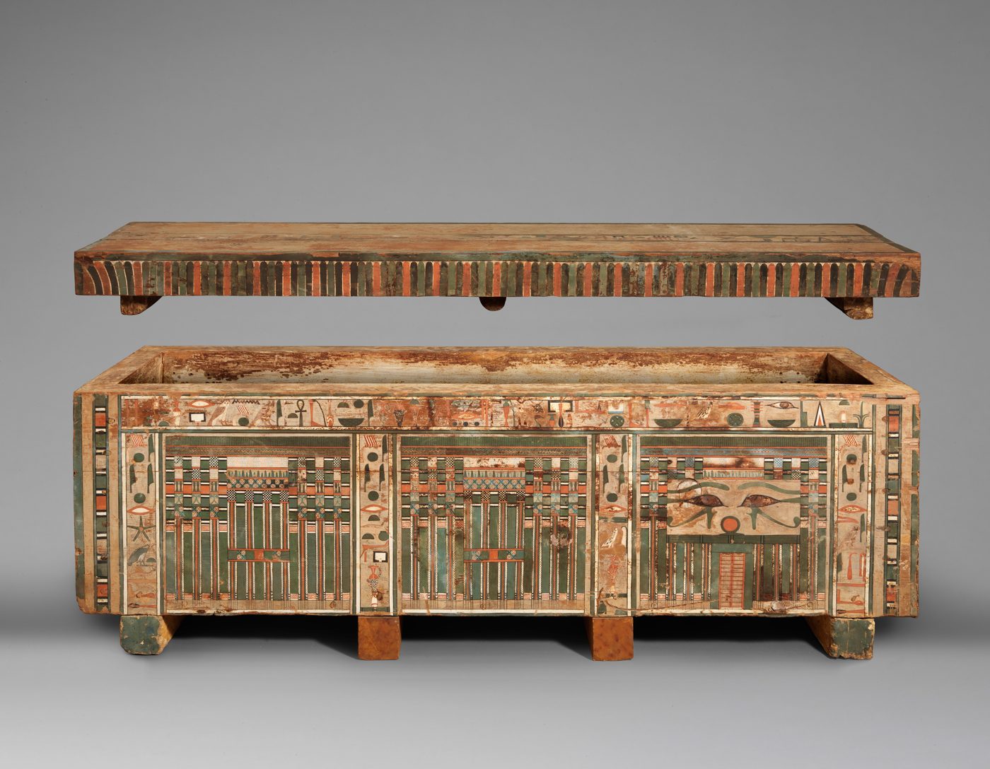
BackgroundThe painted wooden coffin of Khnumhotep with its lid raised, Egypt, about 1981 to 1802 BC. A pair of eyes is painted on the side. The Metropolitan Museum of Art, 12.182.131a, b, Public Domain (Met Open Access).
And forty days were fulfilled for him; for so are fulfilled the days of those which are embalmed: and the Egyptians mourned for him threescore and ten days.
Genesis 50:3, KJV
Genesis says Joseph's physicians embalmed Jacob over forty days, the Egyptians mourned seventy days, and Joseph himself was later embalmed and 'put in a coffin in Egypt' (Genesis 50:26). The Metropolitan Museum of Art in New York shows the still-wrapped mummy of a steward named Khnumhotep (not the Beni Hasan governor of the same name). He wears a gilded mask and a faience collar (faience is a glazed ceramic), and his painted wooden coffin is shown in the same room. Egypt's antiquities ministry describes the whole embalming process as taking about 70 days, with the body dried in natron (a natural salt) for about 40 of those days. These numbers are close to the forty and seventy days in Genesis 50:3.
Where it is today
The Metropolitan Museum of Art, New York, Gallery 112: mummy 12.182.131c and coffin 12.182.131a, b (probably from Meir in Middle Egypt). Embalming tools and mummies can also be seen at the Mummification Museum in Luxor, Egypt.
Date
Khnumhotep's mummy and coffin: about 1981 to 1802 BC (Middle Kingdom, 12th Dynasty).
Why this label: This is real Egyptian burial practice, and it matches the details in Genesis 50. It is not the mummy or coffin of Jacob or Joseph.
Good to know: The Greek writer Herodotus (about 450 BC) also gives 70 days, but he says the body lay in natron for the whole 70 days. In Genesis the 70 days are days of mourning. So the match with Genesis is close but not exact. Joseph's mummy has never been found, and Exodus 13:19 says his bones were carried out of Egypt.
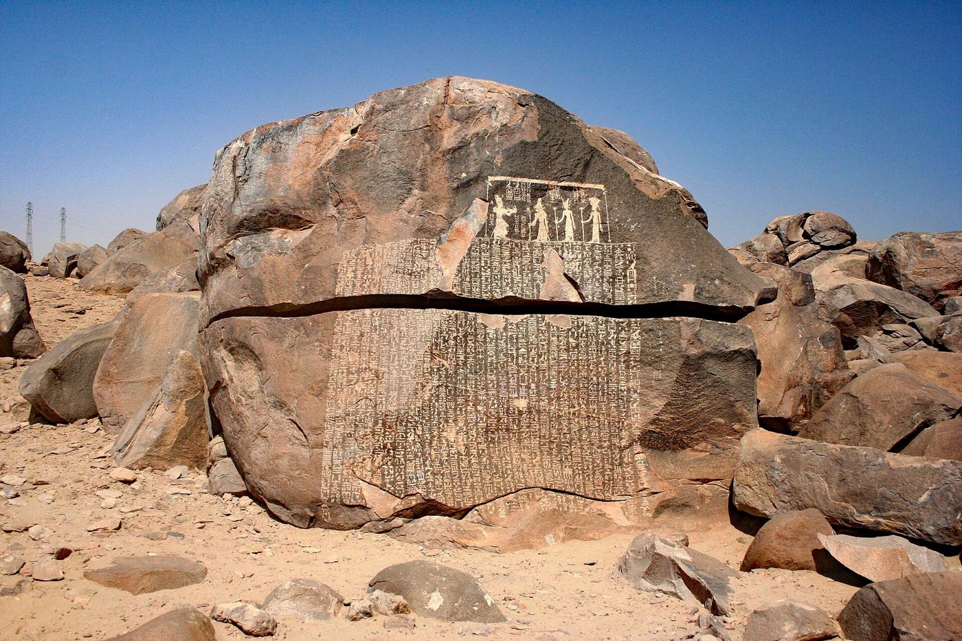
BackgroundThe Famine Stela on Sehel Island. At the top, King Djoser faces three gods; the columns of writing fill the rock below, across a natural crack. Morburre, CC BY-SA 3.0.
And the seven years of dearth began to come, according as Joseph had said: and the dearth was in all lands; but in all the land of Egypt there was bread.
Genesis 41:54, KJV
The Famine Stela is an inscription in Egyptian hieroglyphs (the old Egyptian writing that uses small pictures), set out in 32 columns on a granite boulder on Sehel Island near Aswan. A 'stela' is a stone slab or smoothed rock face carved with writing. It tells how, under King Djoser, the Nile failed to flood for seven years and Egypt suffered famine. Djoser's adviser Imhotep learns that the god Khnum controls the flood. Khnum promises in a dream to bring the flood back, and the king gives land and income to Khnum's temple. Because it speaks of seven years of famine, it is sometimes linked to Joseph's seven years of famine in Genesis 41.
Where it is today
Sehel Island, in the Nile near Aswan, Egypt (still in place on the rock).
Date
Carved when Greek kings (the Ptolemies) ruled Egypt, probably under Ptolemy the Fifth (205 to 180 BC). The story is set in the reign of Djoser, about 2670 BC (experts' dates differ by a few decades).
Why this label: The inscription is real, but it does not name Joseph or point to him. It was written about 2,500 years after the king it describes, and Egyptologists such as Miriam Lichtheim think priests of Khnum wrote it to support their temple's claims. It shows that Egyptians told stories of a 7-year famine, so it is background to the Joseph story, not evidence for or against it.
Good to know
Famine stories: Early scholars wondered whether it was a memory of Joseph's famine. More recent study notes that 'seven years of famine' was a common theme in old stories from the Near East, including other Egyptian and Mesopotamian texts. At most it shows that Egyptians feared long failures of the Nile flood, which is the kind of famine Genesis describes.
The Joseph canal: A canal leading into the Faiyum is called the Bahr Yussef, the "Waterway of Joseph". Its modern Arabic name refers to the prophet Yusuf, the Arabic form of Joseph; in ancient times it had other names. Egyptian kings of the 12th Dynasty enlarged the canal, and no ancient record links it to Joseph.
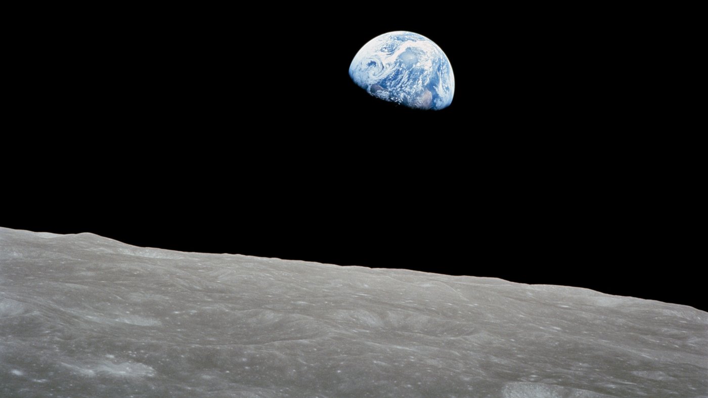
Earthrise, photographed by Bill Anders from Apollo 8 on 24 December 1968, the same day as the reading. NASA, public domain.
This is not a Bible event, but it belongs here. On Christmas Eve, December 24, 1968, the three men of Apollo 8 became the first people ever to circle the Moon. During a live television broadcast, with the camera pointed out the window at the Moon passing below, they took turns reading Genesis 1:1 to 10 from the King James Bible. Bill Anders read verses 1 to 4, Jim Lovell read verses 5 to 8, and Frank Borman read verses 9 and 10.
In the beginning God created the heaven and the earth. And the earth was without form, and void; and darkness was upon the face of the deep. And the Spirit of God moved upon the face of the waters. And God said, Let there be light: and there was light.
Genesis 1:1 to 3, KJV
Borman closed by wishing God's blessing on “all of you on the good Earth.” The famous Earthrise photograph, showing the Earth rising over the Moon, was taken on this same mission.
 LearnAboutHim